Appendix C
Background
It is a requirement of the Environmental Assessment (Scotland) Act 2005 that plan-making authorities provide details of the character of the environment which may be affected by their plan, including any existing pressures and the likely evolution of the environment in the absence of the plan. The A96 Corridor Review will be assessed against this baseline to provide an indication of the type and significance of any environmental impacts that could arise.
There are many requirements for environmental protection and enhancement detailed within existing legislation, programmes, strategies, plans and policies at the international, UK and national levels across all the SEA topics. These requirements form the context for the SEA. Under each SEA topic, a high-level summary of the existing environmental protection requirements is provided in Appendix B (Plans, Programmes & Strategies Review).
The environmental baseline covered in this appendix applies to a 15km-wide corridor (7.5km either side of the existing A96 Trunk Road). This corridor was used by the previous A96 Dualling SEA (Halcrow (2014) A96 Dualling Programme – Strategic Environmental Assessment – Tier 1 Environmental Report.), and is illustrated on the figures provided in Appendix A (Environmental Figures). Presenting the baseline at this level allows the SEA to reflect on the interaction of the A96 Corridor Review with wider environmental trends.
Current trends and pressures will be explored further for each SEA topic scoped into the assessment, and information will be drawn from a range of sources, including the Scottish Government, NatureScot, Historic Environment Scotland (HES), the Scottish Environmental Protection Agency (SEPA), and Scotland’s Environment Web, amongst others.
The study area includes a wide range of natural capital assets, including, forests, moorland, rivers, lochs, farmland, coastal areas as well as the seabed. As stated in the Natural Capital Asset Index, a range of benefits or ecosystem services can be derived from these assets, and these will be set out in the baseline.
Climatic Factors
Baseline
Greenhouse Gas Emissions
In 2019, domestic transport was the largest source of net emissions in Scotland at 12MtCO 2 e ( Scottish Government (2021) Scottish Greenhouse Gas Emissions 2019, ) . Domestic transport is understood as transport, excluding international aviation and shipping (emissions from domestic aviation, road transport, railways, domestic navigation, fishing and aircraft support vehicles). According to the Scottish Transport Statistics 2021, transport accounted for 29.2% of Scotland’s total greenhouse gas emissions in 2019. The largest source of transport emissions is cars at 38%, followed by HGVs at 25%, and aviation at 16% ( Transport Scotland (2021) Scottish Transport Statistics 2021, ) . In addition, 25% of emissions were generated by a combination of LGVs & HGVs. The proportion of single occupancy car trips also shows an underlying increasing trend, with 66% in 2018 compared with a figure of 65% in 2013 and 60% in 2008 ( Transport Scotland (2020) Transport and Travel in Scotland – All editions ) .
Climate Change
There is consensus in the scientific community that anthropogenic climate change poses an ongoing threat to the planet. The uninhibited consumption of fossil fuels since the industrial revolution has steadily increased the atmospheric concentration of greenhouse gases to unprecedented levels. This increasing concentration has amplified the ‘greenhouse effect’ where the carbon dioxide (CO 2 ) traps heat from the sun, resulting in higher average global temperatures. A minor increase in global temperature threatens to imbalance delicate tipping points, causing uncontrollable and irreversible changes to ecosystems, such as melting permafrost that would release significant amounts of methane and the melting of polar ice caps, causing sea-level rise.
The Climate Projections report ( Adaptation Scotland (2021) Climate Projections for Scotland ) indicates that over the last few decades, Scotland has experienced a warming trend, shifting rainfall patterns, and rising sea levels. Key changes include:
- Scotland’s 10 warmest years on record have all occurred since 1997. The average temperature in the last decade (2010-2019) was 0.69°C warmer than the 1961-1990 average, and the warmest year on record was 2014.
- There has been an increase in rainfall over Scotland in the past few decades (with an increasing proportion of rainfall coming from heavy rainfall events). The annual average rainfall in the last decade (2010-2019) was 9% wetter than the 1961-1990 average, with winters 19% wetter.
- Mean sea level around the UK has risen by approximately 1.4 mm/year from the start of the 20th century.
Historic climate data for the study area has been obtained from the Met Office ( Met Office (2022) Historic station data ) recorded by the closest meteorological station to the A96 corridor (Nairn, location: 57.593, -3.821) for the period 1981-2010 and is presented in Table C2.1.
| Climatic Variable | Month | Value |
|---|---|---|
|
Average annual maximum daily temperature ( C) |
n/a |
12.02 |
|
Warmest month on average ( C) |
July |
18.66 |
|
Coldest month on average ( C) |
December |
0.45 |
|
Mean annual rainfall levels (mm) |
n/a |
606.86 |
|
Wettest month on average (mm) |
October |
67.37 |
The Met Office historic 10-year averages from the meteorological stations in Kinloss, Keith and Aberdeen Airport identify gradual warming and increased rainfall between 1961 and 2020 in the study area ( Met Office (2022) UK climate averages ) . Information on mean maximum annual temperatures and mean annual rainfall recorded by the meteorological stations within the study area which are: Kinloss, Keith and Aberdeen Airport is summarised in Table C2.2.
Table C2.2: Historic 10-year Averages for Temperature and Rainfall
Aberdeen Airport
|
Climate Period |
Mean Max annual temp ( C) |
Mean Annual Rainfall (mm) |
|
1961-1990 |
11.48 |
790.13 |
|
1971-2000 |
11.74 |
799.89 |
|
1981-2010 |
11.96 |
814.93 |
|
1991-2020 |
12.21 |
832.55 |
Kinloss
|
Climate Period |
Mean Max annual temp ( C) |
Mean Annual Rainfall (mm) |
|
1961-1990 |
11.91 |
620.61 |
|
1971-2000 |
12.15 |
624.36 |
|
1981-2010 |
12.39 |
664.64 |
|
1991-2020 |
12.67 |
662.68 |
Keith
|
Climate Period |
Mean Max annual temp ( C) |
Mean Annual Rainfall (mm) |
|
1961-1990 |
11.18 |
876.42 |
|
1971-2000 |
11.41 |
845.34 |
|
1981-2010 |
11.68 |
883.63 |
|
1991-2020 |
12.01 |
888.75 |
Inter-relationships with other Topics
Biodiversity
Grassland habitats, forestry and peatland within the corridor have significant carbon sequestration value but are also important for biodiversity. Any positive or negative effects of the A96 Corridor Review on these natural assets would therefore affect both SEA topics.
Soils
Soils may be altered by changes to rainfall patterns, erosion and increased temperatures due to climate change, while the release of CO 2 sequestered in peat soils from development contributes to climate change.
Peatland conservation is therefore essential for climate change mitigation.
Material Assets
The materials required to construct any transport options have embodied carbon emissions that will be released in the manufacture of components of the infrastructure. The natural material assets within the route corridor including forestry and peat soils, hold a high carbon sequestration and sink value.
Water Environment
Climate change projections indicate that this region will experience wetter winters and more regular high intensity rainfall events which could affect the resilience of the corridor.
Evolution of the Baseline and Trends
Greenhouse Gas Emissions
The Climate Change (Emissions Reduction Targets) (Scotland) Act 2019 amended the greenhouse gas emissions targets in the Climate Change (Scotland) Act 2009 and set a ‘net zero’ target emissions year of 2045 by which time emissions are to be 100% lower than the baseline year of 1990.
To facilitate delivery of the long-term targets, Scotland’s climate change legislation also includes annual targets for every year to net zero. The levels of these targets are set out in Table C2.3 ( Scottish Government (2022) Policy: Climate change, Reducing greenhouse gas emissions ) .
| Year | Percentage reductions from the 1990/1995 baseline |
|---|---|
|
2018 |
54.0% |
|
2019 |
55.0% |
|
2020 (interim target) |
56% |
|
2021 |
57.9% |
|
2022 |
59.8% |
|
2023 |
61.7% |
|
2024 |
63.6% |
|
2025 |
65.5% |
|
2026 |
67.4% |
|
2027 |
69.3% |
|
2028 |
71.2% |
|
2029 |
73.1% |
|
2030 (interim target) |
75% |
|
2031 |
76.5% |
|
2032 |
78.0% |
|
2033 |
79.5% |
|
2034 |
81.0% |
|
2035 |
82.5% |
|
2036 |
84.0% |
|
2037 |
85.5% |
|
2038 |
87.0% |
|
2039 |
88.5% |
|
2040 (interim target) |
90% |
|
2041 |
92.0% |
|
2042 |
94.0% |
|
2043 |
96.0% |
|
2044 |
98.0% |
|
2045 |
100% (net zero emissions) |
Various plans and policies, including the NTS2 and its Delivery Plan and the Climate Change Plan, have since been implemented to facilitate and encourage the required reduction in emissions by 2045 ( Scottish Government (2020) Securing a Green Recovery on a Path to Net Zero: Climate Change Plan 2018–2032 ) . Key proposals include vehicle technology improvement (increased uptake of electric and low carbon vehicles), alternative fuels, and demand management and behaviour change with a shift towards sustainable travel modes (walking, cycling and public transport); all of which will reduce emissions from the transport sector over the coming decades.
A key component of Scotland’s climate change strategy is to encourage a shift to more sustainable forms of transport, away from private vehicles. The long-term trends for public transport and vehicular travel remain uncertain, and it is currently unclear whether there would be an increase or reduction in greenhouse gases as a result.
Climate Change
The effects of climate change are expected to continue to exacerbate, even as Scotland transitions to a low-carbon economy. Climate change projections indicate that the climate trends observed over the last century will continue and intensify over the coming decades.
Key long-term climate change trends for Scotland are that average temperatures will increase across all seasons. Typical summers will be warmer and drier, winters will be milder and wetter and sea levels will rise. Heavy rainfall events will become more frequent in the coming decades, exacerbating flooding and landslide incidents ( Adaptation Scotland (2021) Climate Projections for Scotland ) .
Climate change has the potential to increase the occurrence of extreme weather events in the study area, with increases in mean summer and winter temperatures, increases in mean precipitation in winter and decreases in mean precipitation in summer. This is likely to increase the risks associated with climate change, with an increased need for resilience and adaptation.
The future baseline data is based on UK Climate Projections 2018 (UKCP18) data from the Met Office ( Met Office (2018) UK Climate Projections User Interface ) . UKCP18 uses a range of possible scenarios, classified as Representative Concentration Pathways (RCPs), to inform differing future emission trends. Representative Concentration Pathways (RCPs) are used in the process of modelling possible future climate evolution. They capture assumptions about the economic, social and physical changes to environment that will influence climate change within a set of scenarios. RCPs Radiative forcing targets for 2100 have been set at 2.6, 4.5, 6.0 and 8.5 watts per square metre and these targets are incorporated into the names of the RCPs; RCP2.6, RCP4.5, RCP6.0 and RCP8.5. Each pathway results in a different range of global mean temperature increases over the 21st century. These RCPs “… specify the concentrations of greenhouse gases that will result in total radiative forcing increasing by a target amount by 2100, relative to preindustrial levels”. RCP8.5 has been used for the purposes of this assessment as a worst-case scenario - this is the UK Government’s recommended approach.
Temperatures
The weather will remain variable and may become more variable, as the amount of change that occurs will depend on the level of reduction in greenhouse gas emissions globally.
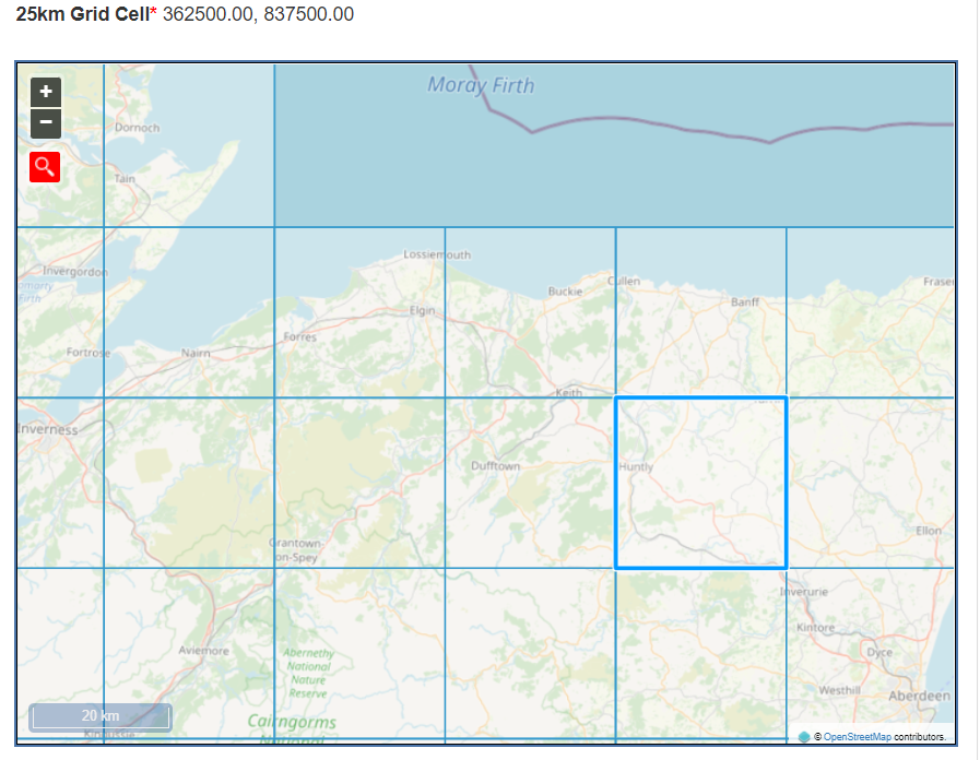
The obtained projections for temperatures changes do not materially vary across the 25km grids within the study area. Table C2.4 presents data from the 25km grid in the central part of the study area, as per Figure C2.1 and can therefore be applied to the whole study area.
These figures are expressed as temperature/precipitation anomalies in relation to the 1981-2010 baseline. The figures in bold are the central estimate (50th percentile). The figures in the following section are the range of change that is considered likely (10th-90th percentile).
| Climate Variable | 2020-2049 | 2040-2069 | 2070-2099 |
|---|---|---|---|
|
Change in mean annual air temperature anomaly at 1.5m (°C) |
+0.89 (+0.35 to +1.48) |
+1.56 (+0.67 to +2.53) |
+3.04 (+1.52 to +4.69) |
|
Change in mean summer air temperature anomaly at 1.5m (°C) |
+0.81 (+0.10 to +1.52) |
+1.54 (+0.31 to +2.82) |
+3.22 (+1.09 to +5.48) |
|
Change in mean winter air temperature anomaly at 1.5m (°C) |
+0.91 (-0.09 to +1.94) |
+1.52 (+0.28 to +2.82) |
+2.82 (+0.95 to +4.86) |
|
Change in maximum summer air temperature anomaly at 1.5m (°C) |
+0.77 (-0.11 to +1.69) |
+1.59 (+0.03 to +3.19) |
+3.40 (+0.76 to +6.18) |
|
Change in minimum winter air temperature anomaly at 1.5m (°C) |
+0.87 (-0.11 to +1.94) |
+1.50 (+0.26 to +2.95) |
+2.83 (+0.80 to +5.20) |
Precipitation
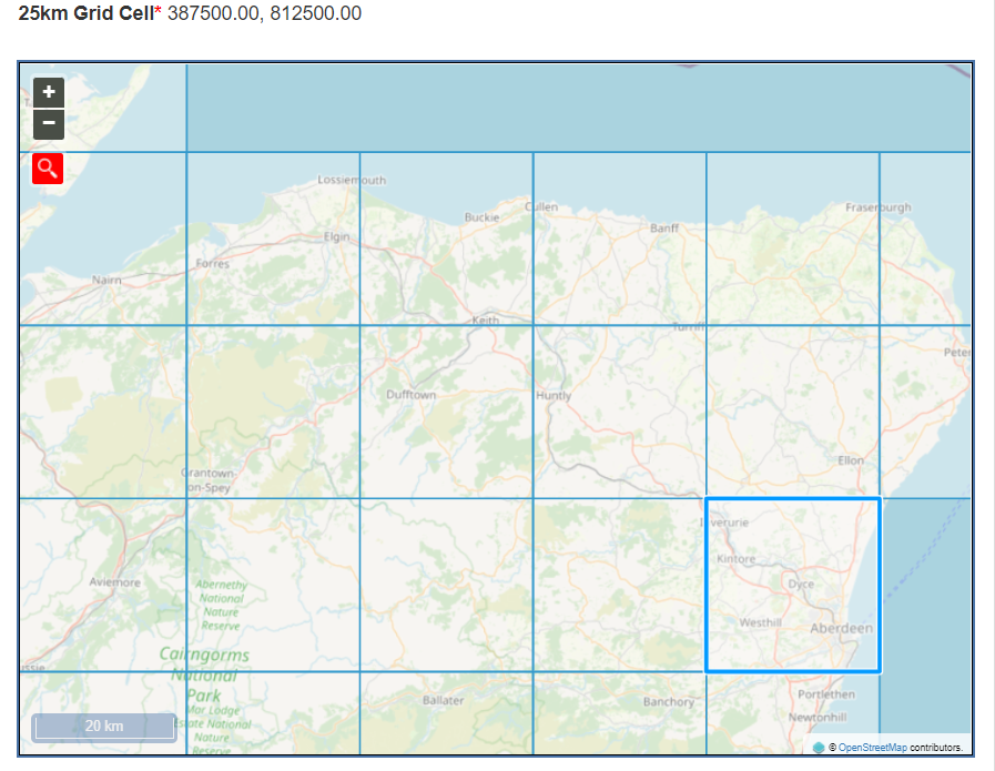
Table C2.5 presents precipitation data from the 25km grid in the eastern part of the study area (see Figure C2.2) which had the highest precipitation values. The figures in bold are the central estimate (50th percentile). The figures in the following sections are the range of change that is considered likely (10th-90th percentile).
|
Precipitation Variables (%) |
2020-2049 |
2040-2069 |
2070-2099 |
|
Change in annual precipitation rate anomaly (%) |
+5.26 (-0.59 to +11.12) |
+4.43 (-3.28 to +12.26) |
+6.21 (-3.12 to +15.72) |
|
Change in summer precipitation rate anomaly (%) |
-1.07 (-9.89 to +7.70) |
-8.47 (-22.31 to +5.26) |
-16.53 (-36.14 to +1.94) |
|
Change in winter precipitation rate anomaly (%) |
+16.88 (+1.50 to +33.75) |
+20.92 (-0.17 to +44.14) |
+33.13 (+0.75 to +70.04) |
Sea Level
Climate change will exacerbate flood events, with rising sea levels increasing the risk of coastal flooding. More frequent, high-intensity rainfall will increase the risk of flash flooding from surface water or sewers for inland communities. Increased frequency and intensity of rainfall may also result in greater risk of river flooding due to higher river flow volumes and flashier flow regimes.
A changing climate is also expected to have ecological impacts, such as warmer sea temperatures and an increasing rise of non-native species spreading and becoming established in aquatic environments.
UKCP18 probabilistic projections have been analysed for the 25km grid square for the coastline locations within the study area. Projected sea level doesn’t vary significantly within the 25km grids in the coastline locations in the study area.
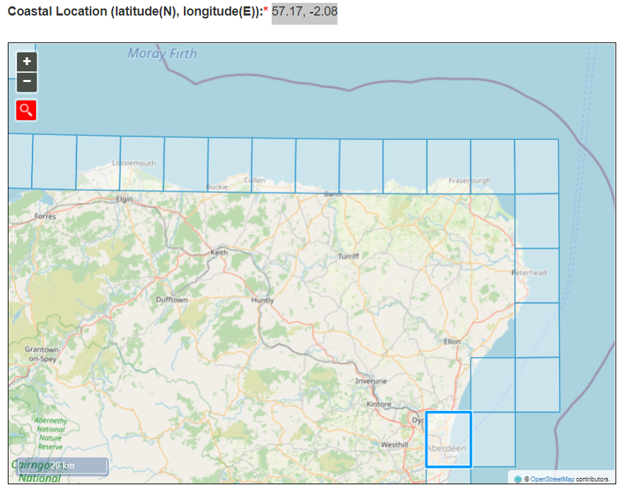
Table C2.6 presents data from the selected 25km grid, as per Figure C2.3, which can be applied to the areas of coastline throughout the whole study area.
|
Projected Changes in Sea Level Rise |
2020-2049 |
2040-2069 |
2070-2099 |
|
Changes in Sea Level (m) |
+0.13 to +0.36 |
+0.13 to +0.36 |
+0.26 to +0.72 |
For other 25km grids for coastline locations within the study area: the change for period 2020-2049 was +0.07 to +0.19.
Air Quality
Baseline
Poor air quality can have detrimental impacts on human health and quality of life. Air pollution stems from the release of substances into the atmosphere from a variety of sources, including organic and man-made sources. Despite this, air quality is still a concern for many in the country, particularly those living in urban and industrial areas. Poor air quality can result in human health conditions such as asthma, respiratory problems and cardiovascular disease ( Royal College of Physicians (2016) Every breath we take: the lifelong impact of air pollution ) , discussed further in Section 4 (Population and Human Health). The UK government estimates that air pollution reduces the life expectancy of every person in the UK by 7-8 months, with related costs of up to £20 billion to the economy annually ( Air Quality in Scotland (2019) About air quality ) .
Transport is a significant contributor to nitrogen oxide (NO x ) and particulate matter (PM 10 and PM 2.5 ) emissions and the transport sector is the most significant source of air pollution in the UK ( Department for Transport (2021). Transport and Environment Statistics 2021 Annual Report ) . Transport generates just over one-sixth of Scotland’s total particulate matter and over one-third of the total emissions of NO x . The majority of these emissions are caused by road transport. Emissions of NO x from road transport are reducing but not at the expected rate ( Scottish Government (2015) Cleaner air for Scotland: the road to a healthier future ) (Scottish Government (2021) Cleaner Air for Scotland 2: Towards a Better Place for Everyone.).
A set of Air Quality Standards and Objectives have been developed in Scotland for several pollutants of concern for human health ( Scottish Air Quality (2020) Air Quality Standards and Objectives, ) . Air Quality Management Areas (AQMAs) are designated by local authorities to cover areas where Air Quality Strategy Objectives (AQOs) in relation to harmful objectives are not (or are unlikely to be) met. Where an AQMA is declared, local authorities are required to develop and implement a plan to improve air quality in the AQMA ( Scottish Air Quality (2020) Local Air Quality Management ) .
Air quality within the A96 corridor is generally good. A review of air quality monitoring data collected within the corridor between 2015 and 2019 for the council administrative areas of Moray and Aberdeenshire show that annual mean concentrations of nitrogen dioxide (NO 2 ) remained stable and well below the Air Quality Objective (AQO) across the years reviewed (Moray Council (2020) 2020 Air Quality Annual Progress Report (APR) for Moray Council.) (Aberdeenshire Council (2021) 2021 Air Quality Annual Progress Report (APR).) . The highest monitored NO 2 concentrations in 2019 within Moray and Aberdeenshire corridor were 22.7µg/m and 25.9µg/m respectively, which were substantially below the annual mean NO 2 AQO of 40µg/m . Air quality within the Highland Council area is also generally good, with the exception of the existing Air Quality Management Area (AQMA) declared for the potential exceedance of NO 2 within Inverness city centre, however this is beyond the corridor area (The Highland Council (2020) 2020 Air Quality Annual Progress Report (APR) for The Highland Council.). The highest 2019 NO 2 concentration within the Highland Council A96 corridor was 33.0µg/m ; again, below the annual mean NO 2 AQO.
There are no declared AQMA within the A96 Corridor Review Environmental study area however there are three declared within Aberdeen City Council area, all to the east of the A96 Corridor Review Environmental study area, and one, as previously discussed in the paragraph above, to the west within Inverness. Anderson Drive AQMA within Aberdeen City was declared for the potential exceedance of annual mean nitrogen dioxide (NO 2 ) and particulate matter (PM 10 ) AQOs (Aberdeen City Council (2021) 2021 Air Quality Annual Progress Report (APR) for Aberdeen City Council.). The AQMA encompasses Haudagain Roundabout and Auchmill Road on the northern fringes of Aberdeen and includes the junction between the A96 and A92 but while including part of the A96, as noted it is outwith the A96 Corridor Review Environmental study area ( Aberdeen City Council (undated) Air quality management ) .
The highest NO 2 concentration relevant to public exposure in 2019 within the A96 Corridor Review Environmental study area was 38µg/m , although this does not exceed the NO 2 AQO. Whilst there is no PM 10 monitoring data within the A96 corridor area, PM 10 monitoring is undertaken within the wider Aberdeen City area. The highest PM 10 concentration in 2019 was 14.0µg/m , which is the highest within all the local authorities in the corridor and is below the annual mean AQO of 18µg/m . The highest PM 2.5 concentration in 2019 within all of the local authorities considered was 8µg/m (data capture <75%) and is below the annual mean AQO of 10µg/m .
Mapped background annual mean concentrations of oxides of nitrogen (NO x – a precursor for NO 2 ), NO 2 , PM 10 and PM 2.5 , based on a 2018 reference year, projected to 2023, were obtained from the LAQM support tools provided by the Department for Environment, Food and Rural Affairs (Department for Environment, Food and Rural Affairs (Defra) (2021). Local Air Quality Management. Technical Guidance LAQM.TG (16).) ( Department for Environment, Food and Rural Affairs (2022). 2020 NO2 and PM projections data (2018 reference year), ) (Defra) for use in air quality assessments. The backgrounds are provided for the UK as a 1kmx1km grid network. A summary of the minimum and maximum background concentrations across the A96 corridor area for 2023 is provided in .
Table C3.1 .
|
Pollutant |
AQO |
Minimum (2023) |
Maximum (2023) |
|
NO X |
30 |
1.8 |
42.3 |
|
NO 2 |
40 |
1.5 |
26.3 |
|
PM 10 |
18 |
5.1 |
11.5 |
|
PM 2.5 |
10 |
3.2 |
6.7 |
( Bold indicates exceedance of the relevant AQO)
2023 background concentrations are below the relevant annual mean AQO, with the exception of the maximum NO x concentration, which is set for the protection of vegetation and ecosystems and is not currently assessed by Scottish local authorities ( Scottish Air Quality (2020a) Air Quality Standards and Objectives, ) .
Pollution Climate Mapping
The Pollution Climate Mapping (PCM) model was developed to report on compliance with European Air Quality Directive (EU Directive 2008/50/EC)) Limit Values by Defra (2023) ( Defra (2020). Background Air Quality Maps ) . These Limit Values are still relevant for assessing compliance post-Brexit (United Kingdom (UK) Government (2020). The Environment (Miscellaneous Amendments) (EU Exit) Regulations 2020.) as they have been transposed into UK law (United Kingdom (UK) Government (2010). 2010 No. 1001 Environmental Protection, The Air Quality Standards Regulations 2010.). There are a number of PCM links that correspond to the A96 corridor where 2023 roadside annual mean NO 2 concentrations were predicted to be between 3.3µg/m and 33.6µg/m . Based on these Defra PCM forecasts, concentrations are predicted to be compliant with Limit Values.
Ecological Designations
DMRB LA 105 ( Highways England, Transport Scotland, Welsh Government and Department for Infrastructure., 2019 Design Manual for Roads and Bridges (DMRB) LA 105 Air Quality, ) states that designated habitats are “internationally, nationally and locally designated sites of ecological conservation importance on protected species and on habitats and other species identified as being of principal importance for the conservation of biodiversity”. A preliminary desk study indicates that there are 43 Sites of Special Scientific Interest (SSSI), four Ramsar sites, eight Special Protection Areas (SPAs) and seven Special Areas of Conservation (SACs) within the study area. In addition, Scottish Ancient Woodland Inventory Sites are found within the corridor.
Inter-relationships with other Topics
Climatic Factors
Air quality and climate change are inherently linked. Extreme weather events as a result of climate change can negatively impact air quality. For example, during heat waves, areas of high pressure create stagnant air that concentrates air pollutants in one area, and dry, dusty air during hot weather periods increases the level of particulate pollution. It is not expected that the A96 Corridor Review would result in an inter-relationship between air quality and climate change that would result in significant effects.
Population and Human Health
The link between air pollution and poor health has been set out in this assessment and is discussed in Section 4 (Population and Human Health). There is potential for inter-relationships to arise with air quality and other population effects, for example, noise and vibration, visual impacts, or impacts on accessibility. A combination of impacts arising as a result of the A96 Corridor Review has the potential for cumulative effects on population receptors; such effects will be considered throughout design development and reduced where practicable through appropriate mitigation measures.
Biodiversity
In relation to ecological receptors, air pollution can impact on the functioning of ecosystems, for example, the growth of trees and other fauna can be affected by acid and nitrogen deposition and sulphur dioxide. Air quality effects in relation to biodiversity are discussed in Section 7 (Biodiversity).
Evolution of the Baseline and Trends
As air quality concentrations are below the AQOs and limit values, air quality is not considered a key constraint, with the possible exception of the ecological sites discussed above, due to the largely rural nature of the area. Principal sources of air pollution within the corridor are likely to comprise traffic-related emissions from the A96 itself.
In terms of trends, road traffic emissions are likely to reduce in future years due to increasing numbers of low emission vehicles on the roads, such as the greater prevalence of electric vehicles and the phasing out of diesel engines.
The sustainable public transport initiatives proposed should assist in the decarbonisation of transport and reducing vehicle emissions. These should support wider Scottish Government objectives, particularly those seeking to improve health, through improving air quality and encouraging a modal shift away from private vehicle usage towards public transport and active travel.
Population and Human Health
Baseline
Population
As shown in Table C4.1, Scotland’s overall population increased between 2019 and 2020. While Aberdeen City Council area’s population also increased between 2019 and 2020, Aberdeenshire, Highland and Moray Council areas all experienced a population decline during this same period.
As with Scotland as a whole, Aberdeen City, Aberdeenshire, Highland and Moray Council areas have ageing populations. Between mid-2010 and mid-2020, the percentage of those aged 65 and over increased by 14%, 30%, 27% and 24% in Aberdeen City, Aberdeenshire, Highland and Moray areas respectively, compared to 20% nationally ( National Records of Scotland (2021) Mid-2020 Population Estimates Scotland, ) . Amongst Scotland’s 32 council areas, Aberdeenshire’s population experienced the fourth largest increase in the proportion of those aged 65 and over between mid-2010 and mid-2020.
| Location | Population | Average Pop. Density (persons per km ) | Pop. Change 2019 to 2020 | % Pop. Aged 0 to 15 Years | % Pop. Aged 16 to 64 Years | % Pop. Aged 65 and over | |||||
|---|---|---|---|---|---|---|---|---|---|---|---|
|
Scotland ( National Records of Scotland (2021) Mid-2020 Population Estimates Scotland, ) |
5,466,000 |
70 |
+2,700 (+0.05%) |
17 |
64 |
19 |
|||||
|
Aberdeen City Council ( National Records of Scotland (2021) Aberdeen City Council Area Profile, ) |
229,060 |
1,234 |
+390 (+0.2%) |
16 |
68 |
16 |
|||||
|
Aberdeenshire Council ( National Records of Scotland (2021) Aberdeenshire Council Area Profile, ) |
260,780 |
41 |
-430 (-0.2%) |
19 |
61 |
20 |
|||||
|
The Highland Council ( National Records of Scotland (2021) Highland Council Area Profile, ) |
235,430 |
9 |
-400 (-0.2%) |
16 |
61 |
23 |
|||||
|
Moray Council ( National Records of Scotland (2021) Highland Council Area Profile, ) |
95,710 |
43 |
-110 (-0.1%) |
17 |
61 |
22 |
|||||
Aberdeen is Scotland’s third largest city by population and its fourth most densely populated area ( National Records of Scotland (2021) Mid-2020 Population Estimates Scotland, ) . The largest settlement in Aberdeenshire is Peterhead, which has a population of 19,060 ( Aberdeenshire Council (2020) Population ) . Approximately 48.4% of Aberdeenshire’s population lives in areas classified by the Scottish Government as rural, with 35% living in areas classified as ‘accessible rural’ and 13.4% living in areas classified at ‘remote rural’ ( Scottish Government (2016) Scottish Government Urban Rural Classification 2016 ) . The largest settlement in The Highland Council area is Inverness, which has a population of 63,220 and is the fifth largest of Scotland’s cities by population ( National Records of Scotland (2021) Mid-2020 Population Estimates Scotland, ) . The Highland Council is also Scotland’s largest local authority by area, with a total land area (including all islands at low water) of 26,484km ( The Highland Council (undated) Highland profile – key facts and figures, ) . Approximately 47.4% of Highland’s population lives in areas classified as rural, of which 37.9% is classified as ‘remote rural’ ( Scottish Government (2016) Scottish Government Urban Rural Classification 2016, ) . The largest settlement in Moray is Elgin, with a population of 24,760 ( National Records of Scotland (2016) Mid-2016 Population Estimates for Settlements and Localities in Scotland ) . Approximately 41.6% of Moray’s population lives in areas classified as rural, with 29.8% living in ‘accessible rural’ areas and 11.8% living in ‘remote rural’ areas ( Scottish Government (2016) Scottish Government Urban Rural Classification 2016 ) .
Figure C4.1 indicates the population statistics for the study area, including the most populous cities and towns, Mid-2020.
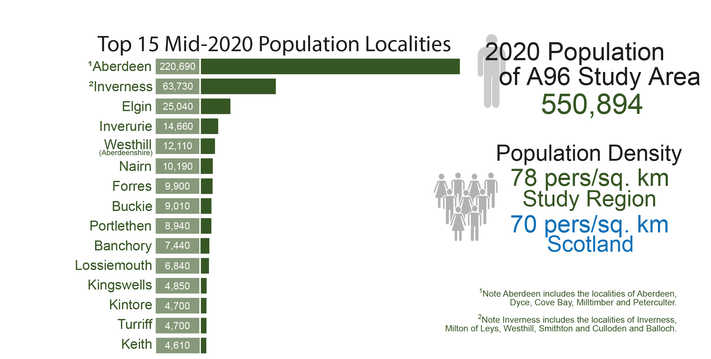
Change in population, as indicated by the 2020 NRS, has seen increases within the SEA study area for each of the local authorities. Within the study area, Aberdeenshire’s population has increased by almost 6% between 2011 and 2020 ( National Records of Scotland, Time Series Data (2021), ) . The areas of Highland Council within the study area have grown in population by 3.5%, whilst Aberdeen City has grown by 3%, and Moray by 2.4%.
On a more local level, evidence from the 2020 NRS mid-year population estimates suggest some individual settlements are growing at a greater rate than the wider council area. Figure C4.2 shows NRS population projections for the period between 2012 ( National Records of Scotland (2014) Mid-2012 Population Estimates for Settlements and Localities in Scotland, ) and 2020 ( National Records of Scotland (2021) Population Estimates Summary (Current Geographic Boundaries), ) for the top 15 most populous settlements in the study area.

Inverurie has shown the greatest proportional growth (15%), followed by Portlethen (9%) and Elgin (9%), whilst Aberdeen and Inverness (including Culloden) have seen population increases of 5% and 6% respectively. However, the population of Lossiemouth has reduced by 10%, Turriff by 7% and Keith by 3%. Other more rural settlements (not included in Figure C4.2) have also shown a population decrease from 2012 to 2020, Huntly (4%) and Oldmeldrum (3%). In general, the data above indicates that population reductions are most likely to occur in the smaller, more rural areas with subsequent increases in the larger urbanised areas of the study area.
Future growth, as predicted by NRS Population Projections ( National Records of Scotland (2020) Population Projections for Scottish Areas (2018-based), ) , is anticipated to be varied by local authority area. By 2043, population in Aberdeen City and Aberdeenshire is anticipated to grow by approximately 2.5% from a 2018 baseline. However, Highland is predicted to decrease by approximately 1%, and Moray by over 2.5%. These percentages are for the whole LA area, therefore may not be representative of the growth in the study area for Aberdeenshire and Highland.
Considering the study area as a whole, there is a clear trend of an aging population, with far greater growth in over 65s from 2011 to 2020 than for under 16s. The trends show that the younger population is growing more in urban areas, particularly in Aberdeen. However, the number of children in more rural areas, including in Moray and Highland, is decreasing. The number of over 65s are growing across the entire study area, though Accessible Rural Areas (42%) and Small Towns (30%) show the greatest proportional increase. The substantial rise of 65 and over population in accessible areas suggests that older people are balancing a rural lifestyle whilst still retaining a reasonable access to the services offered in the urban areas, such as Aberdeen.
Human Health
Exposure to air pollution can exacerbate health inequalities between different demographics. Air quality is explored as a standalone topic in Section 3 (Air Quality). However, there are significant impacts from air quality on human health. For example, short-term increases in particulate matter (PM) levels are associated with acute health effects:
- increased use of medication (e.g. asthma inhalers)
- days off work and days with restricted activity
- hospital admission for lung and heart diseases
- risk of death from asthma, COPD, heart disease ( Ramsay, C. N. (2019) Air Pollution and Health Impacts: A Scottish Context [PowerPoint presentation] Cleaner Air for Scotland Review ) .
The long-term risks of exposure to PM 2.5 comprise:
- increased deaths from heart attack, chronic lung disease, stroke and lung cancer
- estimated reduction in average life expectancy of 3-4 months in Scotland ( Committee on the Medical Effects of Air Pollutants (2010) The Mortality Effects of Long-Term Exposure to Particulate Air Pollution in the United Kingdom, ) .
Reducing traffic-related air pollution can improve people’s sense of wellbeing, as well as physical health and the quality of the environment ( European Environment Agency (2020) Healthy environment, healthy lives: how the environment influences health and well-being in Europe, ) . Transport is a significant contributor to poor air quality in urban areas and although emissions from transport have declined over the years, the rate of the decline has started to level off ( Scotland’s Environment (undated) Air quality: Key messages ) . Due to several common sources, most notably road traffic in urban areas, there is also a close relationship between air quality and environmental noise ( Scottish Government (2015) Cleaner air for Scotland: the road to a healthier future, ) .
Environmental noise is defined as “unwanted or harmful outdoor noise creased by human activities, including noise emitted by means of transport, road traffic, rail traffic, and from sites of industrial activity” ( European Commission (2002) Environmental Noise Directive, ) . Noise from transportation is the biggest source of environmental noise in Scotland, and population exposure to environmental noise has been linked to adverse health effects. Annoyance and sleep disturbance are the key direct impacts on the population.
Scotland’s noise map ( Scottish Government (2022) Scotland's Noise Map. ) illustrates noise exposure from rail, road, air traffic and industrial sources in accordance with the European Parliament and of the Council Directive for Assessment and Management of Environmental Noise 2002/49/EC (commonly known as the European Noise Directive (END)) and shows the majority of parts of the A96 ranges between 55 and 60 dB L den ,. Noise data for the environmental study area are shown on Figure A3 in Appendix A (Environmental Figures).
Nearer to the cities/towns of Inverness, Nairn, Forres, Elgin, Keith, Huntly, Inverurie, and Aberdeen, the traffic noise is rising to higher levels of 70dB L den . In some areas, the noise level exceeds 80dB L den , particularly near Inverness and Aberdeen International Airports.
The greatest consolidated noise sources are at the eastern end of the A96 due to the proximity to Aberdeen and its associated various industrial land uses and main transport routes entering and exiting the city. This is beyond the study area. Within the study area itself, the main sources of noise are from the A96 and the railway line which both follow a similar east-west alignment. There are some peripheral roads which are also noise sources, however these are more scattered in the western extent or form direct connections with the A96. Noise emissions from airports and industry outside of Aberdeen have not been modelled as they do not meet the criteria set out in the END.
The END also requires the production of Noise Action Plans (NAPs) to manage noise. These NAPs identify locations where people are most likely to be annoyed by noise (Candidate Noise Management Areas [CNMAs]) and areas to be preserved (Candidate Quiet Areas [CQAs]) from the strategic noise mapping. These areas then go through a filtering process to determine which will progress to actual Noise Management Area (NMA) and Quiet Area (QA) status.
Responsibility for assessing the potential for implementing cost effective noise mitigation measures within NMAs rests with either Transport Scotland, Network Rail, or the local roads authority, depending on who is responsible for the road/rail. There is one Round 3 CQA which falls within the study area, which is ‘West Woods’ located south of A96 and west of A90. There are 12 road CMNAs and two rail CMNAs proposed within Aberdeen and five road CMNAs in Inverness, however these are outside the study area.
Deprivation
People living in deprived areas in Scotland are more likely to die early from disease and have more years of ill health ( Public Health Scotland (2021) Impact of deprivation on health ) . The Scottish Burden of Disease Study (2016) Deprivation Report noted that more deprived areas have double the rate of illness or early death than less deprived areas, and that people living in Scotland’s wealthiest areas are more likely to live in ill health than die prematurely due to ill health, and that the number of years of life affected by ill health are much fewer ( Public Health Scotland (2021) Impact of deprivation on health ) . Those living in deprived areas are also more vulnerable to the effects of environmental change, due to the prevalence of pre-existing health problems and inequities amongst these communities.
The Scottish Index of Multiple Deprivation (SIMD) 2020, is a tool used to identify areas where poverty and inequality exist within Scotland to allow targeted investment in these areas. Scotland’s 6,976 data zones are ranked from most to least deprived using 38 different indicators of deprivation across seven ‘domains’ comprising: income; employment; health; education, skills and training; geographic access to services; housing; and crime.
Of Aberdeen City’s 283 data zones, 29 were identified as being amongst the 20% most overall deprived data zones in Scotland, including one which was identified as being within the 5% most overall deprived data zones across the country ( Scottish Government (2020) Scottish Index of Multiple Deprivation 2020v2 local and national share calculator ) . Of Aberdeenshire’s 340 data zones, nine were identified as being amongst the 20% most overall deprived data zones in Scotland. Of Highland’s 312 data zones, 30 were identified as being amongst the 20% overall most deprived data zones in Scotland. Five of Highland’s data zones were also identified as being within the 5% most deprived data zones in Scotland, three of which are located within Inverness. Of Moray’s 126 data zones, four were identified as being amongst the 20% overall most deprived data zones in Scotland.
There is a link between areas of lower socio-economic status and higher levels of obesity, which has harmful effects on health such as diabetes, heart disease and some cancers. Scotland’s obesity rates continue to be amongst the highest in the developed world and are a significant public health issue ( Scottish Government (2017) A healthier future – action and ambitions on diet, activity, and healthy weight: consultation ) . In particular, women and children in the most deprived areas are affected by more extreme obesity ( Public Health Scotland (2021) Diet and healthy weight, ) . In 2018, 65% of individuals in Scotland were overweight, 28% of whom were obese ( Scottish Government (2020) Scottish Health Survey 2018: main report - revised 2020 ) .
Access to Active Travel
Access to active travel is an important factor in combating obesity, as well as having beneficial impacts on mental health and wellbeing. In 2018, the proportion of Scottish adults meeting physical activity guidelines for moderate or vigorous physical activity (MVPA) was 66% ( Scottish Government (2020) Scottish Health Survey 2018: main report - revised 2020, ) . MVPA is understood as at least 150 minutes of moderate physical activity, 75 minutes of vigorous physical activity, or an equivalent combination of the two, per week ( Scottish Government (2020) Scottish Index of Multiple Deprivation 2020v2 local and national share calculator ) . There is a range of factors that can impact on levels of exercise, and these include the built environment and transport systems that encourage active living and regular physical activity. Adherence to the MVPA guidelines is also more common amongst adults in less deprived areas, declining from 74% in the least deprived areas to 54% in the most deprived areas ( Scottish Government (2020) Scottish Health Survey 2018: main report - revised 2020, ) .
Public access assets are described in Section 5 (Material Assets) of this appendix.
Access to Services
The study area includes predominantly rural areas, interspersed with settlements. The key settlements in the study area are Inverness, Nairn, Forres, Elgin, Fochabers, Keith, Huntly, Inverurie and Aberdeen. Access to integrated transport infrastructure is a key concern within rural communities. Increasing connectivity between modes of transport can also provide various benefits, such as reducing congestion and supporting more sustainable modes of transport. Barriers to accessing healthcare is an influencing factor for causing health inequalities. Affordability and adequate provision of public transport, as well as integrated public transport, act as barriers to those on lower incomes or in certain areas accessing healthcare facilities. In the rural regions, there is greater reliance on private vehicles due to a lack of regular public services and road travel being the only method of transport.
Recreation and Tourism
The North East of Scotland is renowned for its whisky industry, with the region being home to the world-famous Malt Whisky Trail. The heritage trail consists of eight single malt distilleries and a cooperage in the Speyside region of Moray, attracting over 800,000 visitors in 2017 alone ( Woodard, R. (2018) Scotch boosted by record visitor numbers ) . The North East is also home to a wealth of castles and stately homes. With over 260 castles, Aberdeenshire is known as ‘Scotland’s Castle Country’, boasting more castles per acre than any other region of the UK ( VisitScotland (2022) Scotland’s Castle Trail, ) .
The landscape in the North East of Scotland also provides opportunities for recreation and tourism. Aberdeen and Aberdeenshire are home to over 50 golf courses and golf links, owing to the sand dunes that stretch along Aberdeenshire’s 165-mile coastline. The River Spey, Scotland’s third longest river, begins at the outlet of Loch Spey in the Scottish Highlands and flows 160km east and north-east into Moray where it discharges into the Moray Firth at Spey Bay. Also, Scotland’s fastest flowing river, the Spey is internationally renowned for its Atlantic salmon and trout fishing opportunities, which are worth around £15 million to the local economy ( Spey Catchment Initiative (2022) About the River Spey, ) . In addition, the River Spey offers several opportunities for recreation including canoeing, kayaking and rafting on the river, and walking and cycling on the adjacent Speyside Way, one of Scotland’s Great Trails.
Woodland and forests also provide opportunities for recreation and tourism throughout the North East region. Several woodlands located close to settlements are regularly used for recreational purposes, including Hill of Mulundy (Forres), Roseisle Coastal Forest (Burghead and Findhorn), Monaughty Wood (Elgin), Lossie Forest (Lossiemouth), Back o’ Bennachie (Insch) and Tyrebagger Woods (Aberdeen and Kintore). Nationally renowned gardens and arboreta also attract significant numbers of visitors to the North East of Scotland each year, many of which are located within the grounds of the region’s castles and stately homes. Access to woodlands and outdoor green space provide opportunities for people to experience and enjoy nature regularly, which is important for human health and quality of life.
Safety
Currently, accidents or incidents (e.g., roadworks, landslips, flooding) occurring on any part of the A96, can significantly impact residents, businesses and visitors due to the significant length of alternative routes and the travel times involved.
It is expected that the A96 Corridor Review would improve safety on the road network.
Inter-relationships with other Topics
Air Quality
The A96 Corridor Review has the potential to affect air quality. Exposure to air pollution can exacerbate health inequalities between different demographic groups, and there are significant effects from air quality on human health both in the short term and the long term.
Climatic Factors
The A96 Corridor Review has the potential to affect climatic factors through carbon emissions and flood risk in the area. Climate change affects many of the social and environmental determinants of health such as clean air, safe drinking water, sufficient food supplies and secure shelter ( World Health Organisation (WHO) (2018) Climate change and health , ) . In addition, people living in flood prone areas, or remote or island communities, can be particularly susceptible to extreme weather events, the severity of which is exacerbated by climate change. More frequent flood events, storms and strong winds can cause damage and disruption to such communities, limiting access to vital services and impacting on people’s physical and mental health (Scottish Government (2019) Climate Ready Scotland: climate change adaptation programme 2019-2024.). The A96 Corridor Review will also consider the resilience of the corridor to the effects of climate change.
Material Assets
The population relies upon material assets for everyday functions. Built transport assets are used to facilitate travel and natural assets, such as forestry and peat, provide a range of benefits for people including as energy sources, and as carbon sequestration for mitigating the effects of climate change. Forests also provide important health and wellbeing benefits, as described in the next paragraph. Disruption to the transport network or loss of material assets, as a result of the options could result in effects on the population such as journey delays and removal of the benefits of carbon sequestration of forestry and peat, and of the positive effects of forests on health and wellbeing.
Biodiversity, Cultural Heritage, and Landscape and Visual
There are relationships between the Population and Human Health topic and the Biodiversity, Cultural Heritage, Landscape and Visual Amenity SEA topics, due to the numerous health and wellbeing benefits provided by access to nature, cultural heritage and greenspaces, providing people with opportunities to participate in recreational activities and experience the local landscape qualities of the region. This is of particular importance during or after pandemics, especially for those without or with limited access to such spaces. Proposed options will have the potential to affect all of these topics and therefore result in effects on population and human health.
Evolution of the Baseline and Trends
Between 2018 and 2028, the populations of Aberdeen City, Aberdeenshire, Highland and Scotland as a whole are projected to increase, while the population of Moray is projected to decrease. By 2028, Scotland’s population is expected to increase from 5.4 million to 5.5 million (+1.8%). By mid-2028, Aberdeen City’s population is projected to increase by 1.1%; Aberdeenshire’s population is projected to increase by 2.5%, and Highland’s population is projected to increase by 0.5%, while Moray’s population is projected to decrease by 0.1% ( National Records of Scotland (2021) Mid-2020 Population Estimates Scotland ) ( National Records of Scotland (2021) Aberdeen City Council Area Profile ) ( National Records of Scotland (2021) Aberdeenshire Council Area Profile ) ( National Records of Scotland (2021) Highland Council Area Profile, ) ( National Records of Scotland (2021) Highland Council Area Profile ) .
Barriers to health equality will persist unless action to remove them is taken – for example, relating to accessing health care services or affordable public transport. Improvements to local and strategic roads, such as those being considered as part of the A96 Corridor Review, will be key for ensuring the future reliability of the transport network.
Climate change and associated extreme weather, such as flooding of the water environment, disrupts the lives of individuals and communities, limiting access to vital services and impacting on the population’s physical and mental health; these events are expected to become more commonplace in the future. Coastal erosion caused by climate change could render existing settlements uninhabitable in the future, resulting in population displacement and potentially a lack of adequate housing. Such impacts could potentially lead to social tensions and affect human health. Existing social and health inequalities could be exacerbated as a result of climate change unless action to prevent this is taken.
At the time of writing, the impact of the ongoing COVID-19 pandemic on the health baseline and trends for the study area is uncertain but will be considered in future assessments if more information becomes available.
Material Assets
Baseline
Material assets is a wide-ranging topic, considering the natural and built environment, including housing and critical infrastructure. Material assets in the environmental sense include finite mineral, aggregate and fossil fuel resources. In relation to Material Assets, the wider STPR2 SEA for Scotland aims to promote and improve the sustainable use of the transport network via the following means:
- support improvements to transport technology, interchanges and timetabling
- plan for future capacity of public transport, taking demographic and societal changes into account
- promote sustainable use and management of existing infrastructure
- ensure transport infrastructure contributes to the circular economy.
The mode of travel people choose influences the number of vehicles on the road and therefore the performance and reliability of the asset (i.e., road). Car usage remains the principal mode of transport in Scotland, with 63% of adults recording a journey by car at least once a week and 70% of the adult population holding a driving licence. Transport improvements associated with the A96 corridor, in conjunction with other A-class roads would improve mobility between Aberdeen and Inverness, and also enhance accessibility to the wider trunk road network. Furthermore, this route would facilitate greater access to the 11 rail stations that comprise the rail network within the A96 corridor.
There are multiple core paths concentrated in and around the towns of Inverness, Nairn, Forres, Elgin, Keith, Huntly and Inverurie and along the coast from Findhorn to Portgordon, as well as core paths in forests (Culbin Forest, Bennachie Forest) and along lochs (Loch of Blairs, Millbuies Loch, Loch na Bo, Loch Oire) along the study area. Additionally, there are Rights of Way (ROWs) around the towns of Forres and Elgin, northwest from Keith and ROWs along the coast from Burghead to Lossiemouth.
An extensive network of active travel paths is located throughout the A96 Corridor study area, including four National Cycle Network (NCN) routes, namely:
- NCN1 – a route that links Dover in the south-east of England to Tain in the Highlands of Scotland, via Inverness
- NCN7 – a cycle route running from Sunderland to Inverness
- NCN78 – a cycle route up the west coast of Argyll and Bute, through the Great Glen and finishing in Inverness
- NCN195 – a route which follows the old Deeside Railway Line from Aberdeen to Ballater.
Within the study area, there are six of Scotland's Great Trails, including the Formartine and Buchan Way, Speyside Way, Moray Coast Trail, Great Glen Canoe Trail, Great Glen Way, and Dava Way.
Within the A96 corridor study area, there are 25 public recycling centres and five commercial waste disposal facilities.
The primary mineral resources extracted within the A96 corridor study area include hard rock, peat, sand and gravels.
The physical factors of soil, topography, and climate determine the land's capability for tree growth and future forestry development ( Gauld J.H., Bell J.S., Nolan A.J., Lilly A. (1989) Land Capability for Forestry in Eastern Scotland ) . The section of the study area located in Aberdeenshire consists of soils primarily classified as podzols, peaty gleys, and peat, which, under the Land Capability for Forestry classification system ( Scottish Government (2022) Land Capability for Forestry Scotland. ) , designates forestry as F5 (limited flexibility for trees) and F4 (moderate flexibility for trees). To the north-east of the A96, in the Moray and Inverness areas, the soil range extends to include mineral gleys with sand or loamy textures. These conditions provide land with F2 (very good) and F3 (good) flexibility for the growth and management of tree crops. Areas of natural woodland are scattered across the A96, which are predominantly composed of mixed coniferous forest with a significant presence of native Scots Pine. They are home to a rich diversity of ecosystems, providing a high-quality landscape and substantial economic and social benefits. More than one-third of Moray's land area is covered by forest ( Forestry Commission Scotland (2013) Native Woodland Survey of Scotland. Moray, ) . Furthermore, because forests and climate are intrinsically linked due to the carbon, water, and energy cycles, woodlands and forests play a significant role in climate change ( Forestry Commission Scotland (2012) Achieving diversity in Scotland’s Forest landscapes. Practical Guide ) .
The A96 corridor study area has eight operational renewable energy developments with a total energy capacity of 96MW, and two additional renewable developments have been approved and will increase energy generation by 30MW. There are currently five onshore wind farms, with more in the planning stages.
Flooding poses the greatest long-term climate-related risk to infrastructure performance, but the growing risks posed from heat, water scarcity and slope instability caused by severe weather could also prove significant (Committee on Climate Change (2017) UK Climate Change Risk Assessment 2017 Evidence Report: Summary for Scotland.). Road and rail transport are generally more vulnerable to a changing climate than air and water transport, and flooding is anticipated to be the greatest threat.
There may be a need to upgrade existing roads to the required standard. This infrastructure would have considerable requirements for materials, aggregates and energy for manufacture and construction. This is linked with the ‘climatic factors’ topic due to the energy and carbon intensive nature of infrastructure construction.
Interrelationships with other Topics
Climatic Factors
Carbon emissions originate from the materials used to construct a project, emissions from construction activities and operational emissions from end-users. Changes to land use within the route corridor would affect the carbon mitigation potential from natural sequestration from the soils and forestry. These carbon emissions add to the cumulative atmospheric carbon concentration that amplifies the greenhouse effect, causing climate change.
Soils
Natural material assets encompass agricultural land and soils. The natural capital value of the soil types within the route corridor underpins the ecosystem functions that the soils provide to several other environmental topics.
Water Environment
Natural material assets encompass watercourses and natural flood management. Should the A96 Corridor Review conclude with recommendations for roads-based options, construction of such options would create additional impermeable road surface within the route corridor and remove natural material assets that regulate the water cycle.
Biodiversity
Natural material assets such as watercourses, woodland and soils have high biodiversity value and they therefore need to be protected for their nature conservation value as well as their amenity, carbon sequestration and economic value.
Evolution of the Baseline and Trends
The changing climate is expected to affect material assets in future years. An increase in annual rainfall for Scotland and more frequent, higher intensity rainfall events poses a risk to the transport network from slope instability and resulting landslides. This was tragically demonstrated by the Stonehaven train derailment in August 2020 caused by a landslide, resulting in three fatalities and several injuries.
A key component of Scotland’s climate change strategy is to encourage a shift to more sustainable forms of transport, away from private vehicles. The COVID-19 pandemic has caused a dramatic fall in the use of public transport due to the inability to socially distance. It may take several years for public transport demand to return to pre-pandemic levels, which may hamper efforts to reduce private vehicle use, putting greater pressure on the road network from congestion.
Water Environment
Baseline
Scotland’s water environment is essential for all life and activity, ranging from drinking water to maintaining habitats and supporting a significant part of the economy. Scotland has approximately 19,000km of coastline, incorporating 470km of fishing zones that underpin coastal fishing communities. Water is also used for industrial processes, such as whisky production, hydroelectricity generation and recreational activities. Scotland’s rivers and lochs contain 90% of the entire UK’s freshwater and cover 2% of the land area.
Legislation and policies relating to the Water Environment are implemented through European Union legislation, transposed into Scottish Law. The Water Framework Directive (WFD) (Directive 2000/60/EC) was transposed into Scottish law under the Water Environment Water Services (WEWS) Act 2003. Under the WFD, new activities within or near to the water environment must not cause deterioration or prevent the achievement of ‘Good’ Status or ‘Good’ Ecological Potential (for artificial or heavily modified waterbodies). The WEWS Act is delivered through the production of River Basin Management Plans (RBMP), which detail the current condition of waterbodies in the Plan area and set objectives for improvement to ‘Good’ overall status or ‘Good’ Ecological Potential.
There are 294 surface waterbodies within the study area, including the River Ness, River Nairn, River Findhorn, River Lossie, River Spey, River Don and River Dee. The Moray Firth and the Beauly Firth are also located within the study area. Table C6.1 provides a summary of the baseline classifications of each WFD attribute of these surface waterbodies, as reported in the latest available datasets (2020).
| Waterbody | Waterbody ID | Overall Status | Overall Ecology | Overall Hydrology |
|---|---|---|---|---|
|
Moray Firth |
200440 |
Good |
Good |
n/a |
|
200171 (Offshore) |
Good |
Good |
n/a |
|
|
Beauly Firth |
220441 |
Good |
Good |
n/a |
|
River Ness |
23394 |
Moderate |
Moderate |
High |
|
River Nairn |
20305 (Moray Firth to River Farnack) |
Moderate |
Moderate |
Moderate |
|
20306 (River Farnack confluence to source) |
Good ecological potential |
Poor |
Good |
|
|
River Findhorn |
23000 (Dorback Burn to sea) |
Good |
Good |
High |
|
23004 (Tomatin to Dorback Burn) |
Good |
Good |
High |
|
|
River Lossie |
23032 (Waukmill to Arthur’s Bridge) |
Poor ecological potential |
Bad |
Good |
|
23033 (Mosstowie Canal to Waukmill) |
Good |
Good |
Good |
|
|
23039 (Leanoch Burn to Mosstowie Canal) |
Bad ecological potential |
Bad |
Good |
|
|
23043 (upper catchment) |
Good |
Good |
High |
|
|
River Spey |
23065 (River Fiddich to tidal limit) |
Good |
Good |
Good |
|
River Don |
23265 (Dyce to tidal limit) |
Bad |
Bad |
High |
|
23269 (Inverurie to Dyce) |
Good ecological potential |
Moderate |
High |
|
|
23293 (Alford to Inverurie) |
Moderate |
Moderate |
High |
|
|
River Deveron |
23165 (Huntly to Turriff) |
Moderate |
Moderate |
Good |
|
23182 (Black Water to Huntly) |
Good |
Good |
High |
|
|
23188 (Culdrain to Huntly) |
Poor |
Poor |
High |
|
|
23172 (Cairnie Burn) |
Moderate |
Moderate |
High |
|
|
River Dee |
23316 (Banchory to Peterculter) |
Moderate |
Moderate |
Good |
|
23315 (Peterculter to tidal limit) |
Moderate ecological potential |
Bad |
Moderate |
Within the study area, there are three designated bathing waters at Nairn (East), Nairn (Central) and Findhorn. As of the 2021 season, Findhorn bathing water is of excellent quality, Nairn (East) and Nairn (Central) bathing waters are of good quality ( SEPA (2023) Bathing Waters: Summary of last season, ) . There are also eight Drinking Water Safeguard Zones.
There are also two active freshwater aquaculture sites located within the study area at Corgrain Point and Forgue, and two CAR licenced fish farms located at Forgue (freshwater) and Cadboll at Cromarty (seawater) ( Scotland’s Aquaculture (2016) Scotland’s aquaculture, ) .
The transport options which interact with coastal waters will need to consider the potential effects on the water quality of bathing waters, aquaculture and fisheries.
The bedrock [solid] geology of the A96 corridor varies from east to west. The eastern end is underlain by Palaeozoic Sandstone, with the western extents underlain by Pre-Cambrian Metamorphic rocks and Igneous Batholith Intrusions; the central section consists of all these bedrock types. A number of faults are inferred across the study area (based on 1:50,000 mapping) with a higher density of faulting indicated in the area around Keith. There are superficial [drift] deposits consisting of sand and gravel across the entire corridor. Borehole data has shown that there are high groundwater levels at its eastern end. Further west, the water table is only high during winter months. The corridor lies across 14 WFD Designated Groundwater Bodies and 34 WFD Surface Watercourses ( SEPA (2022) Climate change allowances for flood risk assessment in land use planning (Version 2), ) .
Interrelationships with other Topics
Climatic Factors
There is potential for changes to flood risk and hydrology within the corridor as a result of climate change. These changes may exacerbate any effects reported in the SEA.
Population and Human Health
Changes to flood risk may impact receptors within the corridor including population, residential and non-residential buildings and critical and non-critical infrastructure and facilities. Effects are dependent on the extent of the change and could result in positive or negative impacts.
Biodiversity
Changes to water quality and hydromorphology may impact upon aquatic ecology within the corridor.
Soils
Soil run-off or transportation of contaminated soils may impact upon water quality within the corridor.
Cultural Heritage
Increases to flood risk may impact cultural heritage assets within the corridor. Effects are dependent on the extent of the change and could result in positive or negative impacts.
Landscape and Visual
Changes to channel morphology, additional structures, channel realignment or changes to hydrology may also result in impacts to their amenity value and have the potential to affect the integrity of a landscape area within the corridor.
Evolution of the Baseline and Trends
Ongoing key pressures on the surface water environment include urbanisation and intensive agriculture/aquaculture. Rural and urban diffuse pollution also remains a concern for water quality, particularly in relation to agriculture, forestry, and urban development.
Climate change will exacerbate flood events, with rising sea levels increasing the risk of coastal flooding. More frequent, high-intensity rainfall will increase the risk of flash flooding from surface water or sewers for inland communities.
The predicted effects of climate change, such as increased temperatures and changes to rainfall patterns, could affect flows in rivers and impact on water resource availability ( Scotland’s Environment (2014) State of the Environment Report 2014, ) . Increased frequency and intensity of rainfall may result in greater risk of river flooding due to higher river flow volumes and flashier flow regimes. A changing climate is also expected to have ecological impacts, such as warmer sea temperatures and an increasing risk of non-native species spreading and becoming established in aquatic environments ( SEPA (2015) Strategic Flood Risk Assessment: Scottish Environmental Protection Agency (SEPA) technical guidance to support development planning (LUPS-GU23), Version 2, ) .
The impact of climate change is likely to vary regionally; as such, SEPA has recently published updated guidance recommending regional climate change allowances ( SEPA (2019) Flood maps, ) . The study area is located within 10 catchments of the Scotland River Basin District ( Natural Scotland (2015) The river basin management plan for the Scotland river basin district: 2015-2027 ) , and the corresponding regional flow allowances for rivers and sea level rise allowances are provided in Table C6.2.
|
Region |
Regional flow allowance (Total change to the year 2100 (%)) |
Sea level rise allowance (Cumulative rise (in metres) from 2017-2100) |
|
North Highland |
40 |
0.89 |
|
North East Scotland |
34 |
0.87 |
Allowances for peak rainfall intensity are also provided. These are 42% for North Highland and 37% for North East Scotland ( SEPA (2022) Climate change allowances for flood risk assessment in land use planning (Version 2), ) . The above allowances must be considered in the development of transport options.
The current and future flood extents (medium likelihood) from coastal, river and surface water flooding within the environmental study area are shown on Figures A5 and A6 in Appendix A (Environmental Figures).
The main risk of flooding within the A96 corridor is from river flooding. This includes the current route of the A96 itself. The flood mapping illustrates that the River Don poses significant flood risk to roads and settlements between Old Rayne and Dyce, with Kintore and Inverurie at significant risk. The other main settlements within the corridor of Nairn, Forres, Elgin, Fochabers, Huntly and Blackburn show significant areas of flood risk from various watercourses, including the River Spey and River Deveron. Flood protection schemes have been implemented within the corridor, including at Forres (Moray Council ( Moray Council. Flood Management ) ) Elgin and Huntly, and a flood study for Inverurie and Port Elphinstone is underway (Aberdeenshire Council). Coastal flood risk is confined to the coastal settlements within the wider study area of Findhorn, Burghead and Lossiemouth, although the estuary at Findhorn does allow for a greater extent of coastal flood risk inland. There is also some potential coastal flood risk for Nairn.
Biodiversity
Baseline
Biodiversity is a common measure of the variety of living organisms and ecosystems and is often used to assess ecosystem health. Biodiversity and genetic diversity are dependent upon each other; genetic diversity is the main contributor to biodiversity in an ecosystem. Biodiversity provides the ecosystem services that are the basis of life, including the regulation of air and water, soil formation, nutrient cycling, flood regulation and pollination. This distribution of biodiversity has key interrelations with the abiotic environment, such as soil and the water environment.
Legislation and policies relating to biodiversity, flora and fauna are implemented from international to local level to protect the natural environment. At EU level, the Natura 2000 network of sites, now generally referred to as European sites, aims to protect key assets under the Habitats and Birds Directives. As identified in Section 1.6.8, European sites include Special Areas of Conservation (SACs) and Special Protection Areas (SPAs) which will be assessed as part of the Habitats Regulations Appraisal (HRA) for the A96 Corridor Review. Further ecological sites protected by UK legislation and policy include Ramsar wetlands, Marine Protected Areas (MPAs), Sites of Special Scientific Interest (SSSI) and woodland identified on the Ancient Woodland Inventory (AWI).
Aberdeen City Council, Aberdeenshire Council and Moray Council are partners of the North East Scotland Biodiversity Partnership which aims to produce, implement and monitor action plans, such as the North East Scotland Local Biodiversity Action Plan (NELBAP), for a range of important habitats and species throughout the North East of Scotland ( North-East Scotland Biodiversity Partnership (2022), ) . Similarly, the Highland Council, together with NatureScot and Scottish Forestry, co-funds the Highland Environment Form (HEF) which was established to provide an arena for discussion, networking and action on environmental subjects, including the production of the Highland Nature Biodiversity Action Plan 2021-2026 ( Highland Environment Forum (2021). Highland Nature Biodiversity Action Plan 2021 – 2026 ) . Both the NELBAP and Highland Nature Biodiversity Action Plan 2021-2026 identify specific actions for the protection of biodiversity within the study area.
Each planning authority within the study area has also developed a woodland and forestry strategy which highlights the key issues and opportunities in relation to forestry and woodland and sets out strategic actions and objectives for the future stewardship and expansion of forestry and woodland within each council area. The most recent iterations of the woodland and forestry strategies are listed below:
- Highland Forest and Woodland Strategy ( The Highland Council (2018) Highland Forest and Woodland Strategy )
- Moray Woodland & Forestry Strategy Supplementary Guidance ( Moray Council (2018) Moray Woodland & Forestry Strategy Supplementary Guidance, )
- Aberdeenshire Local Development Plan 2017 Supplementary Guidance 8: Aberdeenshire Forestry and Woodland Strategy
- The Granite City Forest: Tree and Woodland Strategic Implementation Plan 2022-2025 (Draft) ( Aberdeen City Council (2021) The Granite City Forest: Tree and Woodland Strategic Implementation Plan 2022-25 (Draft), ) .
The terrestrial environment in the study area includes a variety of forestry, farmland, mountains and moorland, saltmarsh and peatlands, interspersed with numerous rivers.
No National Nature Reserves have been identified in the study area but designated ecological sites and one Local Nature Reserve (LNR), Findhorn Bay, have potential to be affected by the A96 Corridor Review. The study area includes the following nationally designated biodiversity sites:
- 43 Sites of Special Scientific Interest (SSSIs) (biological, geological, and mixed)
- 21 biological SSSIs. The following SSSIs are designated mostly for their woodland, fens and freshwater habitats as well as species of birds:
- Buinach and Glenlatterach
- Cawdor Wood
- Coleburn Pasture
- Craigs of Succoth
- Den of Pitlurg
- Lethenhill
- Loch of Skene
- Loch Oire
- Loch Spynie
- Longman and Castle Stuart Bays
- Lower Findhorn Woods
- Mill Wood
- Mortlach Moss
- Munlochy Bay
- Paradise Wood
- Quarry Wood
- River Spey
- Tilliefoure Wood
- Tips of Corsemaul and Tom Mor
- Wartle Moss
- Whitehill
- 17 geological SSSIs. The following SSSIs are designated for their natural geological features mostly quaternary geology and geomorphology and palaeontology (permian-triassic reptilia and silurian -devonian chordata):
- Ardersier Glacial Deposits
- Bin Quarry
- Boghole, Muckle Burn
- Clashach – Covesea
- Cutties Hillock
- Dalroy and Clava Landforms
- Dipple Brae
- Findrassie
- Hill of Barra
- Masonshaugh
- Pitcaple and Legatsden Quarries
- Pittodrie
- Randolph's Leap
- Scaat Craig
- Spynie Quarry
- Teindland Quarry
- Tynet Burn
- 5 mixed SSSIs. The following SSSIs are designated mostly for their natural coastal geomorphology; coastlands, fens and freshwater habitats as well as species of birds and butterflies:
- Culbin Sands, Culbin Forest and Findhorn Bay
- Kildrummie Kames
- Lower River Spey
- Spey Bay
- Whiteness Head.
31 Aberdeen and Aberdeenshire Local Nature Conservation Sites (LNCSs), four Moray Wildlife Sites and one Scottish Wildlife Trust Reserve have been identified in the study area.
Additionally, there are several internationally designated sites in the wider area which could feasibly be affected by the transport options. These include, but are not limited to:
- four Ramsar sites (Inner Moray Firth, Loch of Skene, Loch Spynie, and Moray and Nairn Coast)
- eight Special Protection Areas (SPAs), (Darnaway and Lethen Forest, Inner Moray Firth, Loch Flemington, Loch of Skene, Loch Spynie, Moray Firth, Moray and Nairn Coast, Tips of Corsemaul and Tom Mor)
- seven Special Areas of Conservation (SACs), (Cawdor Wood, Culbin Bar, Lower Findhorn Woods, Lower River Spey - Spey Bay, Moray Firth, Mortlach Moss, River Spey).
As evidenced by the prevalence of designated sites, the area in the vicinity of the transport intervention options is important for nature conservation. The protected sites support the following principal habitat types:
- The coastline in the study area is designated for important intertidal habitats, including intertidal mudflats and sandflats supporting areas of saltmarsh and eelgrass beds. There are also sand dunes, vegetated shingle and estuarine alder woodland
- Eutrophic lochs, open water transition fen, reedbeds, birch-willow carr, willow-alder carr and alkaline fens, lowland acid grassland, calaminarian grassland and serpentine heath, mesotrophic loch, saltmarsh, hydromorphological mire range, valley fen, upland birch woodland, open water transition fen, juniper scrub, fen meadow, fen-meadow.
Terrestrial species, including birds of conservation interest within the study area include, but are not limited to, small blue butterfly Cupido minimus, dingy skipper butterfly Erynnis tages, pipistrelle bat Pipistrellus pipistrellus, roe deer Capreolus capreolus, majestic red deer Cervus elaphus, black grouse Tetrao tetrix, golden eagle Aquila and osprey Pandion haliaetus.
Freshwater species of conservation interest in the study area include, but are not limited to, nationally scarce plants, slender-leaved pondweed Potamogeton filiformis, coralroot orchid Corallorhiza trifida and baltic rush Juncus balticus and the near threatened lesser tussock sedge Carex diandra. The River Spey SAC is also designated for otter Lutra lutra, freshwater pearl mussel Margaritifera margaritifera and Atlantic salmon Salmo salar.
Sites of national or international significance provide feeding and roosting habitats for a diversity and abundance of designated bird species, including but not limited to migratory and over-wintering birds, wildfowl and waders.
In Scotland, Ancient Woodland is defined as land that is currently wooded and has been continually wooded, at least since 1750 ( NatureScot (2020) A guide to understanding the Scottish Ancient Woodland Inventory (AWI), ) . Ancient Woodlands are usually significantly more biodiverse than more recent woods and are identified in the National Planning Framework 4 (NPF4) as “land that has maintained continuous woodland habitat since at least 1750”. Approximately 297km parcels of woodland listed on the Ancient Woodland Inventory (AWI) are located within the study area, and tree felling would be required, but the exact quantities are unknown at this stage. There are also approximately 394km parcels of native woodland listed on the Native Woodland Survey of Scotland (NWSS) located within the study area.
Key pressures to biodiversity, flora and fauna include the loss, fragmentation and degradation of habitats as a result of development. An Ecological Impact Assessment (EcIA) will identify, quantify, and evaluate potential effects of development-related actions on habitats, species and ecosystems (CIEEM (2018) Guidelines for Ecological Impact Assessment in the UK and Ireland: Terrestrial, Freshwater, Coastal and Marine. Chartered Institute of Ecology and Environmental Management, Winchester.) and enable appropriate mitigation or compensation to be determined for any significant effects. Where licences are required for specific activities to avoid potential breaches of conservation legislation, these will be sought from NatureScot. In addition to designated areas, green spaces within urban and rural areas such as green corridors, parks, and gardens can have important functions and play a valuable role in enhancing biodiversity. Improving green infrastructure and cycling and walking networks can promote active travel, helping to reduce transport emissions and build networks of priority habitats with positive impacts on biodiversity.
Interrelationships with other Topics
Climatic Factors
Changes to climate and the increasing occurrence of extreme weather events could alter available resources, environmental conditions and species’ life cycles within the corridor. Trees, woodlands and peatlands act as ‘carbon sinks’ by sequestering more carbon from the atmosphere than they release. These flora and habitats provide a useful contribution to mitigating climate change. Deforestation and degradation of peatlands results in the release of carbon into the atmosphere, which fuels further climate change.
Air Quality
Changes to air quality within the corridor could impact the resilience of biodiversity. Nitrogen deposition due to vehicle emissions can impact on the functioning of ecosystems and growth of trees.
Noise and Vibration
An increase in noise and vibrations could cause disturbance to species of conservation interest, which could result in avoidance or abandonment of important habitats within the corridor.
Soils
Soils and peat provide habitats and support biodiversity within the corridor. Soil biodiversity is essential to most soil functions and affects the sustainability of species and habitats which rely on soils. Soil sealing would reduce the capacity of the corridor to support habitats and biodiversity and potentially affect the sustainability of species and habitats that rely on soils and soil biodiversity.
Water Environment
Changes to water quality and hydromorphology, including groundwater, could impact biodiversity within the corridor.
Landscape and Visual
Landscape changes could alter habitats and their connectivity, which could result in negative or positive interactions with biodiversity within the corridor. Any mitigation and enhancement measures implemented for landscape and visual amenity could have biodiversity benefits, and vice versa. Therefore, any mitigation planting proposals should be developed with input from both disciplines.
Evolution of the Baseline and Trends
Biodiversity loss has been well documented over the last 50 years, and today there is a range of pressures with the potential to impact on Scotland’s wildlife and biodiversity and the current biodiversity crisis is recognised in NPF4. Key ongoing issues include climate change, land use pressures (e.g., loss or damage of natural habitats from development or agricultural intensification and land use change), and the pollution of air, water, and land. Climate change and future development are the biggest drivers for the possible changes in the future baseline. Whilst a future baseline is difficult to predict for every ecological feature, trends and targets can provide a useful indication of future biodiversity.
Within Scotland’s designated sites (SSSI, SAC, SPA and Ramsar sites), 77.9% of natural features were either in or recovering towards a favourable condition as of 31 March 2021 ( NatureScot (2022) The Proportion of Scotland’s Protected Sites in Favourable Condition 2022: An Official Statistics Publication for Scotland ) . This is an increase of 0.7% since 2011, when 77.2% of natural features were in favourable condition ( NatureScot (2011) The Proportion of Scotland’s Protected Sites in Favourable Condition 2011: An Official Statistics Publication for Scotland, ) . Over the same period, the percentage of qualifying habitats features in favourable condition has increased by 3.8% (from 73.8% in 2011 to 77.6% in 2022), but the percentage of qualifying species features in favourable condition has declined by 3.1% (from 75.4% in 2011, to 72.3% in 2021) ( NatureScot (2011) The Proportion of Scotland’s Protected Sites in Favourable Condition 2011: An Official Statistics Publication for Scotland, ) ( NatureScot (2022) The Proportion of Scotland’s Protected Sites in Favourable Condition 2022: An Official Statistics Publication for Scotland ) . Whilst these figures hide fluctuation between years (such as 80.4% of natural features in favourable condition in 2016, the highest since monitoring began in 2005), they indicate that the percentage of natural features in favourable condition within Scotland’s designated sites will not be significantly different by 2029.
The most recent report on population trends of common breeding birds in the UK, by the British Trust for Ornithology (BTO) (Harris, S.J., Massimino, D., Balmer, D.E., Eaton, M.A., Noble, D.G., Pearce-Higgins, J.W., Woodcock, P. and Gillings, S. (2019). The Breeding Bird Survey 2019 . British Trust for Ornithology (BTO).), highlighted that long-term trends (measured over the longest period of available data, which is usually 50 years) vary between species groups:
- Birds of prey populations have generally increased as a result of a ban on the use of certain pesticides, increased legal protection leading to a reduction in persecution and positive conservation efforts. Persecution of hen harrier on grouse moors and changes in land use have been attributed to population declines in some areas.
- Populations of most waterbird species have increased, likely due to increased water quality and warmer winter temperatures. Conversely, the breeding populations of most wader species (including redshank) in the UK show long-term declines, mostly as a result of habitat loss, intensification of land use and predation of their ground nests.
- The populations of species which are typically found within woodland habitats have generally increased, by being able to make use of green areas within suburban environments and due to warmer winters. Numbers of species which have specialist habitat requirements have declined and this is attributed to fundamental changes in woodland habitat quality in recent decades.
The drive towards Biodiversity Net Gain (BNG), meeting United Nations (UN) sustainability targets in relation to biodiversity and consideration of Natural Capital in policy will be key to the future protection and enhancement of Scottish biodiversity and the wider natural environment.
Soils
Baseline
Soil is a valuable and finite natural resource with a profound effect on health and wellbeing, while also supporting every aspect of the natural and built environment. Its contribution to ecosystem services and environmental goods is now widely acknowledged. Soil has inter-relationships with several SEA topics (as visualised in Figure 4.1 in Section 4.11) and is heavily influenced by a changing climate ( IEMA (2022) A New Perspective on Land and Soil in Environmental Impact Assessment, ) . The classes of soil, as classified by the James Hutton Institute ( The James Hutton Institute (2022) Land Capability for Agriculture in Scotland ) , within the environmental study area are shown on Figure A4 in Appendix A (Environmental Figures).
Scotland’s soils are highly variable due to the diverse geology and climate in Scotland. They play an important role in the carbon cycle during the carbon exchange process. Healthy soils serve as carbon storage; in Scotland, soils are rich in organic matter and account for over 50% of the UK’s soil carbon ( Dobbie, K.E., Bruneau, P.M.C. and Towers, W. (eds) (2011). The State of Scotland’s Soil. Natural Scotland ) . Organic soils store vast quantities of carbon dioxide (CO 2 ), and it is estimated that Scotland’s soils store 3 billion (bn) tonnes of CO 2 ( Scottish Government (2019) Our soils ) . A significant amount of Scotland’s soil is comprised of peatland, which is the largest natural terrestrial carbon sink. Moreover, they are a key part of the landscape and cultural heritage. Peatlands cover more than 20% of the country’s land area, storing 1.6 bn tonnes of CO 2 through carbon sequestration.
However, certain pressures on Scottish soils, such as climate change, changes in land use and land management, including the built environment, could have significant potential effects on soil degradation ( SEPA (2019) Strategic Environmental Assessment Guidance Note 2 (LUPS-SEA-GU2) Guidance on consideration of soil in Strategic Environmental Assessment, Version 3 ) . It is estimated that over 80% of Scotland’s peatlands are degraded, which means they emit more CO 2 than they sequester ( Dobbie, K.E., Bruneau, P.M.C. and Towers, W. (eds) (2011). The State of Scotland’s Soil. Natural Scotland ) . Because soil is part of a complex and interconnected system, its degradation has a wider impact on the environment, society, and the economy ( SEPA (2019) Strategic Environmental Assessment Guidance Note 2 (LUPS-SEA-GU2) Guidance on consideration of soil in Strategic Environmental Assessment, Version 3, ) .
Therefore, sustainable management and protection of soils is key to ensuring that soils can deliver essential functions vital for the sustainability of Scotland’s environment and economy ( SEPA (2019) Strategic Environmental Assessment Guidance Note 2 (LUPS-SEA-GU2) Guidance on consideration of soil in Strategic Environmental Assessment, Version 3, ) , including:
- storing carbon and maintaining the balance of gases in the air
- biomass production (including agriculture and forestry)
- filtering and buffering pollutants
- regulating the flow of and providing storage for water
- providing a physical environment for human activity (including built development)
- providing habitats and supporting biodiversity
- a source of raw materials
- preserving cultural and archaeological heritage.
The study area is located in the North East of Scotland between Inverness and Aberdeen, where soils at lower altitudes are dominated by alluvial soils, particularly in lower river valleys. The majority of peat and peat podzols found at higher altitudes belong to Classes 3, 4 and 5 ( Scottish Natural Heritage (2016) Carbon-rich soils, deep peat and priority peatland habitat mapping: Consultation analysis report, ) . Classes 1 and 2 are considered of national importance. Additionally, mineral podzols predominate over much of the study area in combination with brown soils and mineral gleys. A detailed description of soils, including their location and characteristics, is summarised in Table C8.1.
| Type of soil | Location | Characteristic |
|---|---|---|
|
Mineral podzols |
They are present in most of the study area, including Inverness-shire, Morayshire, Aberdeen City, and the central and eastern parts of Aberdeenshire. |
Mineral podzols play a significant role in facilitating groundwater recharge ( Scottish Government (2019) Our soils, ) . |
|
Alluvial soils |
They are present in most of the study area, including Inverness-shire, Morayshire, Aberdeen City, and the central and eastern parts of Aberdeenshire. |
Alluvial soils serve as the ‘kidney of the earth’ by filtering water, reducing flood risk and influencing climate ( Scottish Government (2019) Our soils, ) . |
|
Peat, peaty podzols and peaty gleys |
Peat and peat podzols occur frequently at higher altitudes throughout the study area. The highest density can be observed south-east of the River Spey, from Moray Council area to Aberdeen City Council area. Peaty gleys are scattered in small amounts across the study area, with the highest concentration in the southern part of Inverness-shire. |
Classes 1- 5 are present in the study area. The study area contains a small amount of peat with nationally important carbon-rich soils, deep peat and priority peatland under Class 1 (areas likely to be of high conservation value) and Class 2 (areas of potentially high conservation value and restoration potential). Class 3 (not priority peatland habitat), Class 4 (area unlikely to be associated with peatland or high carbon soils) and Class 5 (no peatland habitat recorded, soils are carbon-rich and deep peat) – these categories include most of the identified peat (Scottish Natural Heritage (2016) Carbon-rich soils, deep peat and priority peatland habitat mapping: Consultation analysis report,). |
|
Brown soils |
A high frequency occurs from the eastern edge of the Moray Council area to the Aberdeen coastline. |
Brown soils are well-drained and have a high level of fertility and are therefore often cultivated. In Scotland, their occurrence is restricted ( The James Hutton Institute (2016) Brown Earths, ) . |
|
Mineral gleys |
They are present throughout the study area but in higher density in the middle section, between the Moray Council area and Aberdeenshire. |
This type of soil supports a variety of wet plant species used for grazing or forestry ( The James Hutton Institute (2016) Gleys, ) . |
Agriculture is crucial for growing crops, raising livestock, providing ecosystem services and sustaining human needs. It has both beneficial and harmful effects on soil and the environment. In particular, industrial agriculture negatively affects the quality of water resources and air pollution, reducing organic matter and releasing carbon. Furthermore, the climate crisis, the use of pesticides, fertilisers, and erosion can have an adverse impact on soil health ( Scottish Government (2018) Climate Change Plan. The Third Report on Proposals and Policies 2018-2032 ) . Agriculture dominates Scotland, accounting for over 80% of the country's geological area ( Scottish Government (2019) State of Scotland’s soils, ) . Sustainable land management and land restoration need to be prioritised in order to have productive and healthy soils . Using the classification of the Land Capability for Agriculture classification ( The James Hutton Institute (2022) Land Capability for Agriculture in Scotland, ) , the study area comprises a variety of soil types with varying productivity and cropping adaptability, ranging from Class 2 and 3 lands capable of producing a wide or moderate range of crops, to poorer quality Class 6 and 7 land of little use for cultivation. Most of the land equates to Classes 3.1 (land capable of producing consistently high yields of a narrow range of crops and/or moderate yields of a wider range) and 3.2 (land capable of average production, though high yields of barley, oats, and grass can be obtained). Other present Classes are 2 (land capable of producing a wide range of crops), 4.1 (land capable of producing a narrow range of crops, primarily grassland with short arable breaks of forage crops and cereals), 4.2 (land capable of producing a narrow range of crops, primarily on grassland with short arable breaks of forage crops), 5.1 (land capable of use as improved grassland, establishment of the sward and its maintenance present few difficulties) and 5.2 (land capable of use as improved grassland, sward establishment presents no difficulties but physical limitations can cause maintenance problems).
The British Geological Survey mapping covers artificial ground, superficial deposits and bedrock geology. Areas of artificial ground are indicated within the study area as made ground, infilled ground and worked ground. The superficial deposits are variable, consisting of sands, gravels, silts and clays. In the western section of the study area, around Nairn and Forres, the deposits are typically a mixture of River Terrace, Alluvium, Glaciofluvial and Glacial Till with localised peat. Towards the coastal areas, Intertidal and Raised Tidal Flat deposits are present with areas of Blown Sand and Alluvium. Moving east towards Fochabers, the superficials are shown as predominantly comprising Glaciofluvial deposits and Glacial Till, with localised Alluvium and peat. Further east, Glacial Till becomes more widespread across the study area.
The management and mitigation of contaminated land needs to be considered too, as some contaminated sites have been identified within the study area in the towns of Elgin and Huntly. However, additional land may fall into this category as there is no definitive list of all potential contaminated sites in the study area. There are no Special Sites with respect to Part IIA of the Environmental Protection Act 1990 within the study area currently registered with SEPA ( SEPA (2022) Special Sites, ) . A Special Site is contaminated land which meets one of the descriptions in the regulations and has been designated by the local authority.
Within the study area, several areas have been classified as environmentally sensitive. There are 17 geological and five mixed (i.e., biological and geological) SSSIs scattered throughout the area. The SSSIs and Geological Conservation Review (GCR) sites are listed below. Similar to geological or mixed SSSIs, GCR sites contain geological and geomorphological features of national and international importance.
- Ardersier - GCR site
- Ardersier Glacial Deposits – geological SSSI
- Binhill Quarry – geological SSSI/GCR site
- Boghole, Muckle Burn - geological SSSI/GCR site
- Clashach – Covesea - geological SSSI/GCR site
- Clava – GCR site
- Culbin – GCR site
- Culbin Sands, Culbin Forest and Findhorn Bay – mixed SSSI
- Cutties Hillock - geological SSSI/GCR site
- Dalcharn – GCR site
- Dalroy and Clava Landforms – geological SSSI
- Dipple Brae - geological SSSI/GCR site
- Findrassie - geological SSSI/GCR site
- Hill of Barra - geological SSSI/GCR site
- Kildrummie Kames – mixed SSSI/GCR site
- Lower River Spey - mixed SSSI/GCR site
- Masonshaugh - geological SSSI/GCR site
- Pitcaple and Legatsden Quarries - geological SSSI
- Pitsmedden and Pitscurry Quarries - GCR site
- Pittodrie - geological SSSI/GCR site
- Randolph’s Leap – geological SSSI/GCR site
- Scaat Craig - geological SSSI/GCR site
- Spey Bay - mixed SSSI/GCR site
- Spynie - GCR site
- Spynie Quarry - geological SSSI
- Teindland Quarry - geological SSSI/GCR site
- Tynet Burn - geological SSSI/GCR site
- Whiteness Head - mixed SSSI/GCR site.
Inter-relationships with other Topics
Climatic Factors
Soils and peat store carbon within the corridor and help maintain the balance of gases in the air. There is potential for carbon loss to the atmosphere through exposure of and disturbance to organic soils. Sealing of soils would reduce the capacity to assimilate carbon within the corridor. Compaction/structural degradation and erosion can result in loss of carbon storage function and flux of greenhouse gases, thus affecting climactic factors.
Population and Human Health
Soils and peat support industries such as agriculture within the corridor and provide resources and means of employment for the population, thus also supporting human health and wellbeing.
Material Assets
Soils and peat are important natural assets that underpin other ecosystem services within the corridor. Loss of organic matter and soil sealing would have the potential to result in loss of nutrients which in turn would lead to loss of fertility/productivity.
Water Environment
Soils and peat regulate the flow of water and also provide water storage within the corridor. They also filter and buffer pollutants. Soil erosion and runoff from compacted/degraded soils can lead to transportation of contaminated soils which can adversely affect water quality within the corridor, as well as changing hydrological regimes which also has the potential to affect flood risk.
Biodiversity
Soils and peat provide habitats and support biodiversity within the corridor. Soil quality is defined as the ability of soils to carry out essential environmental, social and economic functions. Soil biodiversity is essential to most soil functions and affects the sustainability of species and habitats which rely on soils, whilst soil organisms play a vital role in maintaining soil carbon and soil nitrogen and exchange of greenhouse gases. Soil sealing would reduce the capacity of the corridor to support habitats and biodiversity and potentially affect the sustainability of species and habitats that rely on soils and soil biodiversity.
Cultural Heritage
Soils and peats preserve cultural and archaeological heritage within the corridor. Soil sealing or loss/disturbance of peat may result in loss of historical artefacts or archaeological features within the corridor.
Landscape and Visual
Soils and peat support the growth of plants and trees which provide landscape and visual value within the corridor. Loss of organic matter or soil sealing may result in changes in habitats and land use that may affect visual amenity and landscape character.
Evolution of the Baseline and Trends
Soil formation is very slow. Due to a range of climatic processes, Scottish soils are comparatively younger than other soils. This lengthy process takes hundreds of years for a few centimetres of soil to form ( Scottish Government (2019) Glossary, ) . In contrast, soil degradation occurs very quickly, particularly due to climate change and human activities. The impacts of climate change include temperature change and run-off erosion from high-intensity rainfall, which leads to soil erosion and soil loss through other sources of flooding ( Scottish Government (2019) Scottish Household Survey 2019 ) . Furthermore, certain human activities can also impair the functionality and capability of the soil. With a projected 7% increase in the Scottish population over the next 25 years, as well as further economic growth ( National Records of Scotland (2022) Projected Population of Scotland (Interim) 2020-based ) , sustainable management of this asset will be of the utmost importance, especially in terms of land use and land management. Through land use and land management, soils can be protected from sealing, compaction, loss of organic matter, contamination, changes in soil biodiversity, or even erosion and landslides, with secondary impacts on other environmental receptors and SEA topics. Therefore, if future development in certain sections of the study area is not appropriately managed, soil could be lost to erosion or degraded. Greenhouse gas emissions that are currently sequestered in peat and other carbon-rich soils could also be released into the atmosphere and contribute to climate change, as described in Section 1 (Climatic Factors).
Cultural Heritage
Baseline
Scotland has a unique and varied selection of irreplaceable cultural heritage sites that contribute to quality of life, the character of the country, cultural identity, education and economy. Scotland’s historic assets attracted 18 million visitors in 2016 and over five million paying visitors, providing an educational role and a significant contribution to the tourist economy ( HES (2018) Scotland’s Historic Environment in Numbers 2018, ) . Cultural heritage assets are distributed around the country but can be found in clusters around historic settlements and on the coast.
An estimated £1.2bn was spent on repairing and maintaining the historic environment in 2017, with private investment accounting for 75% of total funding ( HES (2018) Scotland’s Historic Environment in Numbers 2018, ) . To protect valuable historic assets, there is also a process of designation which aims to identify the significance of the historic environment and protect it for future generations to enjoy. According to Historic Environment Scotland, Scotland’s historic environment generated £4.2bn for the economy in 2017 and supports 66,000 full-time jobs ( HES (2020) Scotland’s Historic Environment Audit 2018, ) . Globally, Scotland is ranked 12th out of 50 countries ranked for its reputation of having a rich cultural heritage.
The study area has a rich cultural heritage, with large numbers of Listed Buildings, Conservation Areas, Scheduled Monuments and Gardens and Designed Landscapes, and Historic Battlefields. Category A Listed Buildings, Conservation Areas, Scheduled Monuments, Gardens and Designed Landscapes, and Historic Battlefields are illustrated on the figures provided in Appendix A (Environmental Figures: Figure A1). In particular, there are very large numbers of Listed Buildings and Scheduled Monuments within the study area. There are no World Heritage Sites or Historic Marine Protected Areas within the study area.
In total, the study area contains:
- 1,987 Listed Buildings
- 236 Scheduled Monuments
- 20 Conservation Areas
- 17 Gardens and Designed Landscapes
- four Historic Battlefield Inventory Sites.
Non-designated sites account for 90-95% of the historic environment ( HES (2016) Scotland’s Historic Environment Audit 2016 ) and provide crucial contextual information to help better understand the history and development of the landscape within the study area, as well as the archaeological potential of the area. Aberdeen City, Aberdeenshire, Highland and Moray council areas have approximately 412; 3,092; 2,212 and 5,479 non-designated cultural heritage assets respectively.
There is also potential for previously unrecorded cultural heritage assets to be located within the study area, given the area contains known heritage sites and artefacts dating from the early prehistoric period through to the modern period. Information gathered on both designated and non-designated assets is important for assessing the archaeological potential of the study area.
The designated and non-designated historic landscape and seascape in the study area is also important. The historic landscape has developed as a result of land management, agriculture and settlement patterns.
Inappropriate development is a key pressure on the historic environment, from direct physical impacts to designated, non-designated and unrecorded assets. It can also result in indirect impacts on the setting of heritage assets. Pressure also comes from visitors, land use changes and climate change.
Measures to reduce the need to travel, manage demand and encourage modal shift have the potential to enhance the integrity of the cultural environment in the urban and rural areas through an associated reduction in traffic levels and air pollution from vehicles and an increase in sustainable access to historic sites.
Inter-relationships with other Topics
Climatic Factors
Climate Change can threaten the cultural heritage resource through erosion, flooding and wetter, warmer conditions. Through waterlogging, climate change could also influence soil creep and erosion levels (e.g. gully erosion) and hence any cultural heritage resources within the soil.
Population and Human Health
The long-term viability of Listed Buildings and other cultural heritage resources is very important to local communities and visitors. Cultural heritage resources are also related to the Population and Human Health SEA topic, as Listed Buildings contribute to the understanding of the history of the area, as well as the sense of place and visitor experience.
Soils
The Geology and Soils SEA topic is relevant to cultural heritage, as the protection of peat soils, which are known to exist in the corridor, could potentially contain undiscovered archaeological remains and organic remains. The protection of these soils could therefore be important for the protection of the archaeological remains and organic remains within them.
Landscape and Visual
The Landscape and Visual Amenity SEA topic is relevant, as historic activities have sometimes created a landscape (e.g. historic field systems) or cultural heritage resources could form an integral part of the landscape. Cultural heritage resources are also an important visual amenity and help to create a sense of place.
Evolution of the Baseline and Trends
Inappropriate development will continue to be a key pressure on the historic environment and cultural heritage, unless mitigation is implemented. For example, the development of new transport infrastructure can affect historic landscape and may cause direct damage to heritage assets, their curtilage or setting. Increasing levels of congestion will also continue to affect historic towns, cities and the countryside. Air pollution from transport and other sources can also cause physical damage to heritage assets such as historic buildings.
It is projected that Scotland will become warmer and wetter as a result of climate change, resulting in the increased weathering of stone, rotting timbers and corrosion of metals. Rising sea levels and increased storm events may increase coastal erosion, endangering our historic landscape, structures, buildings and archaeology in the coastal zone. Some of Scotland’s unique and special sites are at most risk. This threat will grow in the future given the predictions of the likely effects of climate change for the remainder of this century.
Landscape and Visual
Baseline
Rich in diversity, Scotland’s landscapes are internationally renowned. Landscapes are a significant part of the country’s cultural and national heritage, contributing to the economy and the wellbeing of the population. They play a key role in attracting tourism and providing opportunity for outdoor recreation. Key landscape designations in the study area are shown on the figures provided in Appendix A (Environmental Figures: Figure A1).
Landscape Character
The Landscape Character Assessment of Scotland ( NatureScot (2019) Scottish Landscape Character Types Map and Descriptions, ) classifies the study area into 30 distinct Landscape Character Types (LCTs) between Inverness and Aberdeen.
Farms and Forested Slopes – Ross & Cromarty
Small sections of this LCT overlap with the western edge of the study area. The Farmed and Forested Slopes – Ross & Cromarty of the northern Inner Moray Firth are located in large tracts on the south side of the Black Isle and the north side of the Cromarty Firth around to the Dornoch Firth, and in smaller areas on the slopes to the south and west of the Farmed River Plains. They also occur on the slopes of Knockfarrel.
Cliffs and Rocky Coasts – Ross and Cromarty
Two small areas of this LCT overlap with the western edge of the study area. This LCT along the Inner Moray Firth occupies the majority of the south-east edge of the Black Isle and the headland from Nigg to just west of Portmahomack. A series of sea cliffs, of both rock and softer material, forms a dramatic rocky coastline.
Coastal Shelf
This LCT occupies a triangle of land between Fortrose and Rosemarkie, extending into the Moray Firth at Chanonry Point at the western edge of the study area. It is located around the eastern perimeter of the area on the coastal edge, at Rosemarkie, Morrich More and the Dornoch Firth. Similar LCTs continue northwards into Sutherland and Caithness, and eastwards to Inverness and Whiteness Head.
Coastal Farmlands - Moray and Nairn
This LCT occupies a large proportion of the western half of the study area. It runs east to west between Inverness and Cullen, in a broad, continuous band some 90km long. This LCT lies on the coastal plain between the coastal shore and forests to the north and farmed and wooded foothills to the south. The central part is locally known as the Laich of Moray.
Rolling Farmland and Woodland
This LCT forms a belt along the south side of Inverness, extending north-eastwards into the study area to form a low ridge between the A96 corridor and the River Nairn valley within the Farmed Strath LCT. It occurs in one broad band which forms a rural backdrop to the west, south and east of Inverness. The distinctiveness and extent of this type is gradually reducing as Inverness and surrounding commuter towns expand.
Farmed Strath – Inverness
This LCT follows the River Nairn valley extending north-eastwards into the study area in a band separated from the A96 corridor by the neighbouring Rolling Farmland and Woodland LCT. It occurs in two locations – at Strathnairn/Stratherrick and Strathglass – where it forms a linear to sinuous channel through the surrounding upland landscape. The straths run south-west to north-east and open to the farmed and wooded slopes and plains around Inverness. The straths are characterised by mainly open farmed valley floors and a central meandering river contained within steep, mainly forested and wooded slopes. Strathglass is narrower, more enclosed and less settled than Strathnairn.
Rolling Uplands – Inverness
This LCT occupies a small area at the south-western edge of the study area. It consists of rolling hills which lie to the south-east of the Great Glen and form an upland backdrop to much of the eastern part of Inverness district, extending far beyond the district boundary and into the Cairngorms National Park. The uplands act as a sheltering edge to the Farmed Strath landscape type, from which they rise. They also form a backdrop to more distant areas to the south, east and west where they seem to merge into an undulating skyline without any clearly identifiable features.
Open Rolling Upland
This LCT occupies an area of high ground at the western end of the study area, which separates the valleys of the River Nairn (Farmed Strath LCT) from the upland valley of the River Findhorn. It is represented in one extensive tract of open uplands in the south-west of Moray cut through by the River Findhorn to form two areas, located on the northern part of Dava Moor and the foothills of the Strathdearn Hills to the south. It forms a relatively narrow band of broad rounded hills, interspersed with shallow valleys and low-lying moss adjacent to the generally lower Upland Moorland and Forestry. The landscape forms part of a more extensive area of similar upland extending south and west into the Highland Council area.
Rolling Farmland and Forests – Moray and Nairn
This LCT occupies much of the western half of the study area to the south of the A96 corridor. Two areas of this LCT are found to the south of the Coastal Farmlands – Moray & Nairn, on the foothills of the higher ground, between the rivers Spey and Nairn. The transition into the Upland Moorland and Forestry LCT to the south is often wide and indefinite, reflecting the gradual rise in elevation and merging patterns of land cover.
Beaches, Dunes and Links – Moray and Nairn
This LCT occupies much of the narrow coastal fringe between Fort George and Buckie in the northern part of the study area. The majority of the Moray and Nairn coastline is Beaches, Dunes & Links – Moray & Nairn, originally formed from the erosion of soft Devonian bedrock which dominate the coastal plain west of the River Spey. It consists of two long narrow sections from Fort George to Burghead and from Lossiemouth to Buckie, between which is a short section of Cliffs and Rocky Coast – Moray & Nairn.
Coastal Forest
This LCT occupies two areas of coniferous forest between Nairn and Burghead. Three extensive areas of this LCT exist south of the Beaches, Dunes & Links – Moray & Nairn of the Moray Firth. These are located west of Burghead, east of Lossiemouth, and east of Nairn where the 14-kilometre long Culbin forest is located.
Narrow Wooded Valley – Moray & Nairn
This LCT crosses the southern half of the study area to the south of Nairn and contains the middle reaches of the River Findhorn, which flows north-east through a channel dissecting the Open Upland, Upland Moorland and Forestry, and Rolling Farmlands and Forests – Moray & Nairn character types, before emerging on the coastal plain near Forres.
Upland Moorland and Forestry
This LCT overlaps the southern edge of the study area in two locations; west of the River Findhorn valley and east of the River Spey valley. The two areas of this LCT, which are separated by the Narrow Wooded Valley - Moray & Nairn of the River Findhorn, form a transition zone between the higher Open Upland to the south, and Rolling Farmland and Forests to the north. The transition to these rolling hills is often indefinite, reflecting the gradually falling elevation and merging patterns of land cover.
Broad Farmed Valley
This LCT crosses the southern part of the study area, south of Fochabers, and contains the lower reaches of the River Spey, as it flows north-east from the Cairngorms National Park boundary to dissect the uplands and moorlands of southern Moray. The valley opens out to the north, to merge with Coastal Farmlands – Moray and Nairn at Inchberry.
Low Forested Hills
This LCT extends across the study area west of Fochabers and occurs in eastern Moray as a ridge of tree-covered higher ground running east to west, located to the south of the Coastal Farmlands – Moray and Nairn.
Upland Farmland
This LCT extends across the study area to the south of the Low Forested Hills LCT. The town of Keith sits at the centre of this LCT at the crossroads of the A95 and A96 and is on the Inverness to Aberdeen railway line. This LCT in Moray is represented by one area of mid-elevation, coastal uplands, to the north-east of the Spey. The character type is positioned between the Low Forested Hills to the north and Upland Farmed Valleys to the south-west. To the east, it transitions into the Low Hills and Basins and Farmed and Wooded River Valley. To the south, it merges into the Farmed Moorland Edge.
Upland Farmed Valleys
This LCT overlaps the southern part of the study area to the south-west of the neighbouring Upland Farmland LCT. The Upland Farmed Valleys LCT is represented by one area in Moray to the east of the Spey and forms a transition between the lower-lying Upland Farmland to the north and the Open Upland to the south.
Farmed Moorland Edge
This LCT, which is bisected by the A96 extends across the study area north-west of Huntly. It lies on the edge of higher moorland Summits and Plateaux - Aberdeenshire, forming a transition between these upland areas and the lowland agricultural heartlands of Aberdeenshire, sharing many characteristics with both.
Open Upland
Two small areas of Open Upland overlap with the southern edge of the study area, east of the River Spey valley and south of Drummuir. This LCT represents extensive tracts of open uplands in the far south-east of the Moray, forming the transition to the Upland Farmed Valleys to the north, and extending south-west beyond the Moray Council boundary, to incorporate the Hills of Cromdale and join the Ladder Hills at the north-eastern edge of the Cairngorm mountains. It also includes the Ben Aigan area. The LCT is severed by and overlooks the Upland Valleys – Moray & Nairn of Glenlivet, Glen Rinnes and Strathavon, as well as the Broad Farmed Valley of the River Spey.
Farmed and Wooded River Valleys
Two bands of this LCT cross the southern part of the study area, following the valleys of the rivers Deveron and the Bogie joining at Huntly, and then continuing north-eastwards across the study area. It comprises the well-settled, wooded and diverse valleys of the rivers Deveron Bogie and Ythan. They form a significant feature within the extensive agricultural heartlands of Aberdeenshire, flowing out to the sea at Macduff. The landscape is attractive with a high degree of integrity.
Outlying Hills and Ridges
Three areas of this LCT are located in the study area either side of the River Bogie Valley to the south of Huntly. This LCT lies at the transition between the high mountains of the Cairngorms and the low farmland of the north-east coastlands in Aberdeenshire. It comprises a series of moorland spurs that extend from the central massif of the Cairngorms into the farmed landscape of Garioch and Formartine, forming prominent areas of high ground.
Farmed Rolling Ridges and Hills
Two areas of this LCT cross the study area either side of the River Bogie Valley to the south of Huntly. This LCT forms a broad swathe of gently rolling farmland lying between the Farmed and Wooded River Valleys to the west and the Farmed Basins LCTs to the south. It is generally more elevated and hillier than the more open plains of the Undulating Agricultural Heartlands which lie to the east of the Deveron. In places, this landscape is punctuated by narrow undulating higher ridges of the outcropping Outlying Hills and Ridges.
Farmed Basin Aberdeenshire
This LCT crosses the study area in a broad belt running between Rhynie and Old Meldrum and is bisected by the A96. It comprises three areas - the ‘Howe of Cromar’, Insch Basin and the ‘Howe of Alford’ in the centre of the county. These areas form flat to gently undulating broad basins surrounded by the higher Outlying Hills and Ridges LCT.
Wooded Estates – Aberdeenshire
A large area at the southern end of the study area, west of Aberdeen, is occupied by this LCT. This LCT occupies a substantial area east of Bennachie between the Don and the Dee valleys and extending to the edge of Aberdeen. It is a landscape of low hills and wide valleys, with dense woodland as a consistent feature.
Coastal Agricultural Plain – Aberdeenshire
This LCT overlaps the study area east of the River Urie valley and Inverurie. It is an extensive LCT comprising a low-lying and often very open sweep of exposed farmland in eastern Aberdeenshire where the influence of the sea is particularly strong. It is characterised by its gently undulating landform, relatively large scale, extensive mosses and the influence of development including transmission masts, electricity transmission lines, the A90 and A953, and the gas terminal at St Fergus on its eastern edge. The transition between the Beaches, Dunes and Links LCT in the east and the hinterland formed by this landscape is very gradual.
Narrow Winding Farmed Valley
This LCT follows the northern side of the River Don valley between Hatton of Fintray and Dyce in the south-east of the study area. It occurs for a small stretch of the River Don, close to Aberdeen, where the river forms the boundary between Aberdeenshire and the city. It forms the northern side of the River Valley - Aberdeen LCT of Aberdeen City. To the west, the landform becomes broader with a less distinct valley shape and is thus included in the Wooded Estates - Aberdeenshire.
River Valley – Aberdeen
This LCT follows the southern side of the River Don Valley between Hatton of Fintray and Dyce in the south-east of the study area.
The Rivers Dee and Don both lie in well-defined granite valleys within Aberdeen and are key features of the city. These rivers form the boundaries of the city with the southern valley side of the Dee and the northern side of the upper Don valley lying in Aberdeenshire. Both the Dee and Don are classified as the River Valley LCT within the Aberdeen Landscape Character Assessment.
The Dee valley continues as a pronounced feature upstream, and is accordingly defined as a separate LCT, the Broad Wooded and Farmed Valley, in Aberdeenshire. The southern valley side of the Dee which lies in Aberdeenshire is also classified as this LCT.
The northern side of the Don valley, which lies in Aberdeenshire, is included in this LCT. The Don valley is less defined as it flows across a broad farmed plain to the west of the city boundary and is thus incorporated into the Wooded Estates LCT in Aberdeenshire.
Low Hills – Aberdeen
This LCT occupies high ground at the east end of the study area, north and south of the A96 corridor near to Dyce and Kingswells. Within Aberdeen City, it comprises well-defined rounded hills with steep slopes which lie on the western and southern edges of Aberdeen, occurring in three locations. Immediately to the west of the city boundary in Aberdeenshire, hills of a similar height (but generally less well-defined in form) are incorporated into the Wooded Estates LCT.
Undulating Open Farmland
Four areas of this LCT are located within the study area north-west of Aberdeen. The largest of these extends from the A96 just east of Blackburn to Kingswells. The Undulating Open Farmland LCT largely forms part of the broader Wooded Estates LCT which extends to the west and, in a narrower sliver, to the north-west of the city in neighbouring Aberdeenshire. It occurs in five locations within Aberdeen City. These comprise both more open, gently undulating farmland as well as well-wooded areas where estates have a greater influence. The finer grain of the Aberdeen City landscape character assessment has resulted in the predominantly open and the more wooded areas within the city area being separately defined at a local level into Undulating Open Farmland and Undulating Wooded Farmland LCTs. There are eight areas where this Undulating Open Farmland LCT occurs.
Wooded Estates Aberdeen
This LCT lies at the eastern end of the study area, extending southwards from the A96 corridor. Within Aberdeen City it occurs in two patches, comprising three locations; Craibstone, Hazelhead Park and Countesswells. These do not abut Aberdeenshire.
Local Landscape Areas
Within the study area, there are a number of Local Landscape Areas (LLAs), the intention of which is to:
- help protect a landscape from inappropriate development
- encourage positive landscape management
- play an important role in developing an awareness of the landscape qualities that make particular areas distinctive
- promote a community’s sense of pride in its surroundings.
In Aberdeenshire, important landscapes are designated as Special Landscape Areas.
Sutors of Cromarty, Rosemarkie and Fort George LLA (Highland)
This LLA spans the Moray Firth to the north-east of Inverness, taking in the coastline between Fortrose and the Carse of Delnies within the study area. This SLA encompasses some of the key landscape features of the Inner Moray Firth. It is an area of contrasts which forms the gateway between the open coast and expansive waters of the Moray Firth and the intimate landscapes of the Cromarty and Inverness Firths. The twin headlands at North and South Sutor which stand guard over the entrance to the Cromarty Firth are another key feature, visible from a considerable distance. Another important juxtaposition is formed by the opposing low-lying promontories at Chanonry and Fort George which reach out to each other and mark the entrance to the Inner Moray Firth. Both promontories have landmark buildings at their seaward extremities and are vantage points in their own right. However, as landforms and as examples of human geography, they are perhaps best appreciated from the higher ground adjacent and to the north.
This elevated perspective also reveals the extensive sandbanks between Fort George and Whiteness Head.
The steep coast between the South Sutor and Rosemarkie provides further contrasts and has some qualities of wildness in an area which is otherwise man-modified or inhabited to some degree.
Culbin to Burghead Coast LLA (Moray)
This LLA includes Culbin and Roseisle Forests and Findhorn Bay in the north-western part of the study area. It comprises part of the renowned Moray coast and the more diverse coastal forest which adjoins it. While all this coast is a popular destination for recreation, it is particularly well-frequented close to Findhorn. The Culbin area includes nationally important coastal features and wildlife habitats. The intriguing history of this stretch of the Moray coast also adds a further dimension to the richness of this landscape with nationally important WWII structures forming an important part of its character.
Findhorn Valley and the Wooded Estates LLA (Moray)
This LLA occupies a broad swathe of land including the Findhorn valley and land either side extending south across the study area from the A96. This designation recognises the richly wooded character of the western part of Moray which is influenced by the long-established estates which border the dramatically incised River Findhorn. While the river, which is covered by national designations for its geological and wildlife value, forms the key feature of this candidate Special Landscape Area (SLA), the woodlands and designed landscapes which lie either side of it, contribute to the richness of this landscape with built features associated with the estates further complementing the whole. The landscape is additionally very well-used for recreation, forming a major attraction within Moray.
Pluscarden Valley LLA (Moray)
This LLA lies in the southern part of the study area between Forres and Elgin. This designation recognises the strongly contained and diversely wooded setting this landscape provides to the Category A-Listed 13th century Pluscarden Abbey which lies at its heart.
Burghead to Lossiemouth Coast LLA (Moray)
This area of coastal landscape overlaps the northern edge of the study area. This section of the coast is particularly scenic as it features the highest cliffs in Moray and comprises a richly complex array of other rocky landform features with some of these designated for their geological interest. This coast is also important in terms of early history with reptile fossils and evidence of early people’s use of caves adding to its interest. Like all the Moray coast, this LLA is well-used for recreation.
Quarrelwood LLA (Moray)
This relatively small LLA is located west of Elgin to the north side of the A96. The close association of this well-used community-run woodland to Elgin and its diverse mix of oak, beech and pine, together with the fascinating prehistoric and cultural heritage of this area, form the key reasons for designation.
Spynie LLA (Moray)
This relatively small LLA lies in the northern half of the study area between Lossiemouth and Elgin. The reasons for designation relate to the variety of the landscape which is significantly enhanced by its distinctive cultural heritage and the nationally important nature conservation interests associated with Spynie Loch. In addition, the close location of the landscape to Elgin, and the presence of Spynie Palace and the loch makes this area attractive for bird watchers, walkers and visitors.
The Spey Valley LLA (Moray)
This LLA crosses the study area to the south of Fochabers where it adjoins the Lower Spey and Gordon Castle Policies LLA. The diverse and handsome landscape of broad gently weaving river, floodplain farmland, wooded valley sides and distinctive settlements together with the romance associated with the Spey due to its connection with whisky distilling are key reasons for designation of this LLA.
Lower Spey and Gordon Castle Policies LLA (Moray)
This LLA extends from the A96 north of Fochabers to meet the Lossiemouth to Portgordon Coast LLA (described below). The two contrasting components of this LLA, the lower Spey Valley and Gordon Castle policies, complement each other. The richness of the Spey for wildlife but also recreational pursuits is recognised in the designation, as is the relationship of the nationally important Gordon Castle policies to Fochabers and its value in providing an attractive setting to the town and to the lower Spey.
Lossiemouth to Portgordon Coast LLA (Moray)
The braided mouth of the Spey and ridged cobble beaches of this LLA are rare features within Moray and include areas designated for their geomorphological and nature conservation importance. Like all the Moray coastline, this LLA is also well-used for recreation although a sense of seclusion is a key characteristic in the more remote middle sections of the coast where scheduled WWII defences have a particularly evocative quality.
Portgordon to Cullen Coast LLA (Moray)
This LLA extends eastwards from the Lossiemouth to Portgordon Coast within the northern part of the study area. The coastal edge is low and rocky in the west and is largely modified to form harbours and quays. East of Findochty however, the coast becomes more diverse with rocky headlands, cliffs, stacks and arches. Sandy beaches are also present, with the largest of these occurring at Cullen Bay. The Bow Fiddle Rock at Portknockie is a celebrated natural arch of tilted banded quartzite lying off the coast. The coast around Cullen (and extending into neighbouring Aberdeenshire) is designated in part for its geological interest.
Deveron Valley Special Landscape Area (Moray and Aberdeenshire)
This LLA crosses the A96 to the west of Huntly. Aspects and features contributing to its designation include:
- Meandering river, framed by rolling wooded hills and ridges, providing views into the valley.
- Strong network of woodland throughout the valley provides landscape structure and wildlife habitat. A variety of woodland types include coniferous plantations, deciduous hilltop copses, shelter belts and a wealth of roadside trees including beech and ash.
- The presence of historic estates has a strong influence along the river, including parkland around Duff House, Forglen and others, but more generally in the wooded landscape.
- The valley landscape forms an important part of the setting of various settlements, including the planned town of Huntly and the market town of Turriff.
- Distinctive local granite architecture displayed in villages and towns, farms and most notably in castles such as Huntly.
- The attractive landscape makes the Deveron a popular setting for a range of outdoor recreation including fishing, canoeing, walking and cycling, with the NCN Route 1 between Banff and Turriff.
- A continuous valley landscape, from the hills to the sea.
Bennachie Special Landscape Area (Aberdeenshire)
The following aspects and features of this landscape are considered worthy of recognition through LLA designation:
- Bennachie is the iconic hill of central Aberdeenshire, instantly recognisable from across the wider landscape, in both long and short-range views.
- Intact landcover of heather moorland on the main Bennachie ridge.
- Extensive woodland across lowland and upland, including native woods, estate policies and forestry plantations, with a substantial amount recognised as ancient woodland.
- Hill forts are found on summits such as Mither Tap and Tillymuick, with cairns and other features emphasising the long history of settlement.
- The River Don is a key feature of Aberdeenshire, meandering through the upland glen south of Bennachie, and across the farmland around Kemnay.
- The farmland to the east provides the setting to Bennachie, but also typifies lowland Aberdeenshire with its mosaic of wooded estates and open farmland.
- A hugely popular area, with walkers enjoying the spectacular views from the Bennachie summits, and Pitfichie being a centre for mountain biking.
- Panoramic views from the upland areas, particularly from the Bennachie summits, over the Don valley and beyond to the patchwork of Aberdeenshire farmland.
Woodland Character
According to the National Forest Inventory, wooded areas occur along the entire study area, concentrating on the outskirts of the towns of Nairn, Forres and Keith. In the southern part of the study area near Inverurie, there is less forestation than in the north. Approximately 26% of the study area is covered by woodland recorded on the National Forest Inventory. Conifers predominate (15%), but there are also areas of fallen trees, broadleaved trees, young trees, shrubs and mixed woodland.
According to the Ancient Woodland Inventory, approximately 28,171 hectares of long-established areas of woodland (of plantation origin) are found within the study area, mainly between Inverness and Huntly. In addition, approximately 1,317 hectares of ancient (of semi-natural origin) woodland are present within the study area. In total, 14% of the study area comprises ancient woodland cover.
According to the Native Woodland Survey of Scotland, there are approximately 31,691 hectares of native woodland and 1,813 hectares of nearly-native woodland present within the study area, totalling approximately 16% of the entire study area. A further 2% of the study area is covered by areas recorded on the Native Woodland Survey of Scotland as open land habitat (approximately 3,142 hectares) and woods planted on ancient woodland sites (PAWS) (approximately 2,661 hectares). Approximately 86,193 hectares (40%) of the study area is also recorded by the Native Woodland Survey of Scotland as being within the pinewood zone, which is the area within Scotland where Scots pine is deemed a native species, and approximately 405 hectares (0.2%) of woodland within the study area is recorded as being within Forest Research Experiment Sites on the National Forest Estate and private land.
In addition, approximately 8,646 hectares (4%) of the study area is recorded as core native woodland on the Integrated Habitat Network (IHN) for native woodlands in Scotland.
Approximately 506 hectares of woodland within the study area are also part of the Woodland Carbon Code, a government scheme administered by Scottish Forestry. The Woodland Carbon Code is a voluntary standard for woodland creation projects in the UK that allows the owners of new woodland planting schemes to calculate the total carbon sequestration that their woodland will achieve over the lifetime of the trees ( Joint Nature Conservation Committee (JNCC) (2021) Woodland Carbon Code ) .
The western part of the study area, between Inverness and Nairn, includes a number of small to medium-sized coniferous forestry plantations along with smaller areas of mixed and broadleaved woodland which tend to be concentrated along riparian corridors, such as the Nairn valley and within policy blocks and belts.
Between Nairn and Elgin, there are several larger coniferous forest plantations including Culbin Forest, which stretches for some 15km along the coastal plain, and upland forestry in the southern part of the study area at Darnaway Forest. There is also a greater concentration of broadleaf and mixed woodland in this part of the study area than west of Nairn, located along the main river corridors including that of the Findhorn which flows from south to north across the study area. South and south-west of Forres, there is extensive woodland cover on either side of the Findhorn valley, comprising a mix of coniferous and broadleaf/mixed plantations. Much of this woodland is included on the Ancient Woodland Inventory (AWI), mainly as long-established woodland (of plantation origin), but there is a significant area of AWI (of semi-natural origin) at Darnaway Forest on the west side of the River Findhorn.
Between Forres and Elgin, the central and northern parts of the study area are relatively open in character and the main areas of woodland are concentrated in the south in large conifer plantations and small broadleaf belts and blocks around Pluscarden, in the north along the coastal plain at Roseisle Forest and substantial broadleaf and mixed woodlands at Quarrelwood west of Elgin.
East of Elgin, there is an informal patchwork of pasture and arable land with woodland cover comprising small mixed and broadleaf blocks, riparian woodland and shelterbelts. Between Lhanbryde and the River Spey, there is greater woodland cover comprising small and medium-sized conifer plantations interspersed with small broadleaf and mixed woodlands. There is virtually continuous broadleaf and mixed woodland cover forming a narrow north-south oriented belt across the study area along the River Spey corridor and wrapping around the town of Fochabers.
To the east of Fochabers is the Wood of Cairnty, an extensive area of forestry plantation covering the central part of the study area north and south of the A96, and the majority of which is included on the Ancient Woodland Inventory as long- established woodland (of plantation origin). Around the town of Keith, the forest gives way to agricultural land with small, scattered woodland fragments including riparian woodlands.
Between Keith and Huntly, there are several medium and large-sized hill forestry plantations in the central part of the study corridor and on the higher ground to the south including Balloch Wood and the Bin Forest. Broadleaf and mixed woodland cover is relatively sparse in this part of the study area, with the main concentrations located towards the northern and southern edges and fringing the larger conifer plantations.
Between Huntly and Inverurie, there are two large areas of coniferous hill plantation in the southern part of the study including Bannachie Forest, but the northern half of the study area is mainly relatively open agricultural land, with a relatively small number of scattered conifer plantations, broadleaf woodlands and policies. The largest concentrations of mixed and broadleaf woodlands are in the central part of the study area North East of Bannachie and west of Inverurie.
Between Inverurie and Aberdeen, the western half of this stretch is characterised by a mosaic of mainly broadleaf and mixed woodland and farmland, with relatively little coniferous plantation. Woodland cover is generally less in the eastern half of this stretch with notable exceptions including various policy woodland and Kirkhill Plantation to the west of Aberdeen.
Tree Preservation Orders (TPOs)
There are various TPOs scattered through the study area, including several close to the existing A96 for example at Nairn, Keith and Thainstone.
Greenbelt
The eastern end of the study area is within the Aberdeen City and Aberdeenshire Greenbelt, the purpose of which is to help avoid coalescence of settlements and sprawling development on the edge of the city, maintain Aberdeen's landscape setting, and provide access to open space.
Key Visual Receptor Locations
Whilst the study area does not contain any nationally recognised scenic viewpoints, or nationally designated landscapes, there are visual sensitivities to some types of development within or visible from the Local Landscape Areas. There are also numerous towns, villages and rural properties, along with numerous paths, recreational trails and areas used for outdoor recreation where there is the potential for visual effects to occur.
Inter-relationships with other Topics
Climatic Factors
Climate change affects landscape directly and indirectly through coastal erosion, flooding, wetter, warmer conditions, as well as droughts and more frequent storm events. In the long term, it can alter landform, landscape pattern and character of the area, influence the plant species composition and distribution within land cover or damage existing landscape elements and features. Climate change can contribute to the spread of pests and diseases, which in turn affects the landscape resource as well as visual amenity (e.g. when a large number of trees die off as a result of pest or disease and need to be felled). Furthermore, climate change adaptation measures affect the landscape and visual receptors through the increasing introduction of renewable energy infrastructure into previously remote landscapes with few signs of human activity. Landscape elements, such as trees and woodlands, act as ‘carbon sinks’ (i.e. absorb and lock away more carbon from the atmosphere than they release) making a useful contribution to mitigating climate change. Conversely, any deforestation (i.e. overall loss in the total area of woodland) equates to the carbon being released back into the atmosphere which fuels further climate change.
Air Quality
Landscape elements, such as trees and other vegetation, absorb pollutants and particulate matter through their leaves and needles and thereby help to improve air quality. Less plant cover means less filtering capacity to clean the air.
Biodiversity
The Biodiversity SEA topic is relevant to landscape, as landscape provides habitat for wildlife. Changes to the landscape resource can alter habitats and their connectivity, which can result in both positive and negative effects on biodiversity, flora and fauna. Conversely, any mitigation and enhancement measures relevant to biodiversity can have an impact on the landscape and visual amenity. For these reasons, any landscape or planting proposals put forward as part of mitigation are normally prepared in consultation with biodiversity specialists. Natural capital considerations and ensuring positive effects for biodiversity can be factored into landscape design considerations to deliver more environmentally sustainable designs.
Water Environment
The Water Environment SEA topic is relevant to landscape as landscape elements and features rely on the water environment and can be damaged by flooding or being subjected to prolonged waterlogging. Conversely, landscape elements such as woodland intercept rainfall, increase transpiration, increase the filtration of surface water and slow the flow of water.
Cultural Heritage
Landscape incorporates cultural heritage resources (assets), which help to shape the historic landscape character. Cultural heritage and landscape both contribute to a sense of place. Cultural heritage assets include inventory gardens and designed landscapes. Some cultural heritage resources also act as landmarks or key viewpoints in the landscape, influence cultural associations of a place and affect the sensitivity of landscape receptors. Cultural heritage assets can also contribute to the visual amenity of the area. Landscape and visual mitigation and enhancement measures can affect cultural heritage assets so should be prepared in consultation with cultural heritage specialists.
Population and Human Health
The Population and Human Health SEA topic is relevant as green and open spaces in the landscape provide opportunities for people to exercise as well as enjoy and experience nature, enhancing their quality of life and improving their physical and mental health and wellbeing. Although anecdotal evidence of the latter has long been known, there is a growing body of scientific research related to this interrelationship and its importance has become highlighted during the COVID-19 pandemic. In addition, tourism and consequently the economic welfare of local communities, often rely on the rich, scenic landscapes of the area. Residential properties, core paths, hill walking trails, long distance walking and cycling routes and roads all serve as locations from which people (i.e. visual receptors) experience views and any changes to them.
Material Assets
Landscape elements (e.g. trees and woodland) provide numerous ecosystem services (i.e. processes by which the environment produces natural resources utilised by us all, such as clean air, water, food and raw materials). These are increasingly recognised and accounted for as Scottish natural capital (i.e. natural assets that humans derive a wide range of services from) and as such, comprise Material Assets.
Soils
Soil supports the growth of plants and trees which constitute part of the landscape resource.
Evolution of the Baseline and Trends
The expansion of many towns and cities and their associated infrastructure, such as roads and railways, is seen as a pressure and the distinctive landscape setting of many towns and cities is being lost due to this settlement growth. Measures that seek to reduce the need to travel, manage demand and encourage modal shift, could in turn reduce the need for new infrastructure and the likelihood of disturbance to the landscape posed by new construction. Other gradual changes to the landscape are likely to result from changes in forestry and farming practices, for example through the intensification to maximise yields.
Rising sea levels and increased storm events resulting from climate change are likely to increase coastal erosion, endangering the landscape in the coastal zone. Climate change also poses a threat to Scotland’s landscape through the loss of habitats, alteration to the intricate ecological balances and increasing prevalence of pests and diseases in the natural environment.
The rapid spread of Chalara fraxinea (ash dieback) is resulting in losses of one of Scotland’s most important climax tree species, which is having a significant impact on the landscape. Evidence from Europe suggests it will lead to the decline and death of 50%-75% of ash trees in Scotland over the next two decades and has the potential to infect more than 75 million ash trees (over 64 million saplings and seedlings and some 10.7 million mature trees) across the country (The Tree Council, Spring 2021 ASH DIEBACK: An Action Plan Toolkit for Scotland.).